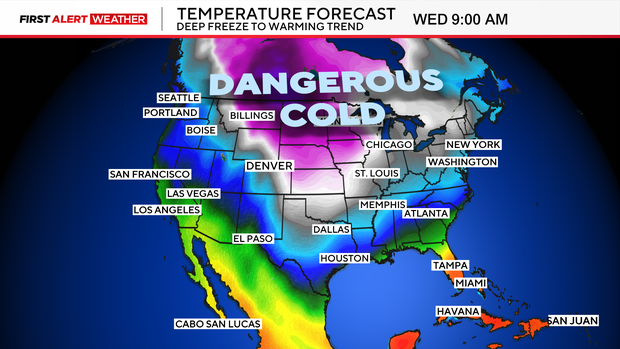
Expect below zero wind chills in Colorado through Wednesday
A First Alert Weather Day is posted for Tuesday night into Wednesday for extreme cold and snow over eastern Colorado as Arctic air continues to pour across the Eastern Plains. All of eastern Colorado will see temperatures in the single digits and below zero. But, the dangerous part of our current pattern is the dangerous wind chill temperatures.
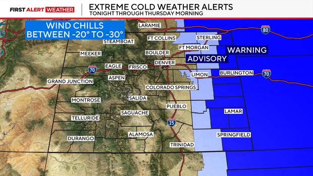
In and around the Denver metro area feels like temps on the bare skin could reach 10 to 20 below zero. Farther east the chills will be even colder than that. There is a Extreme Cold Weather warning for a large part of the eastern plains for wind chill temps to drop between 20 to even 30 below zero through Wednesday morning.
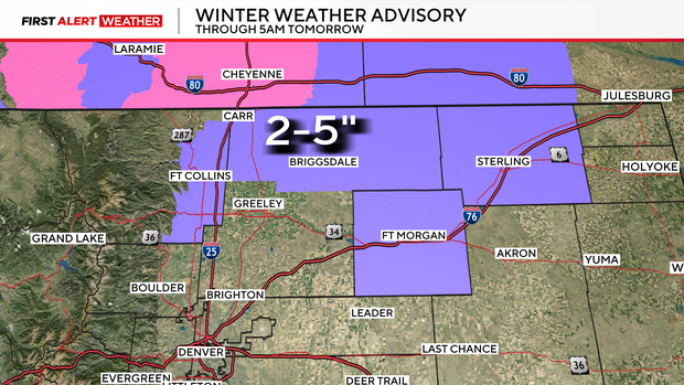
Add into that another shot of heavy banded snow across parts of northeastern Colorado through Wednesday morning.
Some areas from Fort Collins over to Fort Morgan may see 2 to 5 inches of snow. There could be a few isolated areas near Wellington that may see up to 6 inches. A Winter Weather Advisory is posted for these areas through 5am on Wednesday.
The Denver metro area will see lighter amounts of snow with a trace to 1/2 inch in some spots overnight.
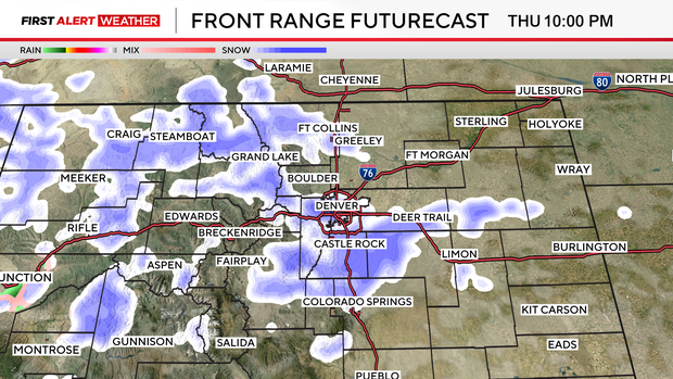
Looking ahead, another round of snow will pop up on Thursday afternoon into Friday with snow for the mountains and the Denver metro area.