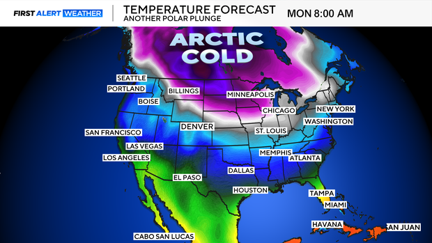
Arctic air heading into Colorado this week while more snow pummels parts of the High Country

Colder air will seep into Colorado this week. And people in the mountains will see more snow starting Monday this afternoon.
There are now Winter Weather Alerts through Tuesday morning from Steamboat to Grand Lake and from Meeker through Aspen to Fairplay. Steamboat may see an additional 20 inches of snow.
Snow could fall at rates of 1-2" an hour at times on Monday. Those intense rates of snow combined with strong, gusty wind could lead to snow squalls in the high country. These snow squalls happen quickly and can rapidly reduce visibility, causing very dangerous travel conditions.

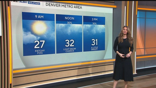
The arctic cold air will move through Colorado between Tomorrow and Thursday. Eastern Colorado could see wind chills 25 below. Tuesday is a First Alert Weather Day because of the cold temperatures. The highs will be in the 20-degree range along the Front Range on Monday.
Avalanche danger is a level 4 out of 5. And winds could gust up to 45 miles an hour. Parts of the Colorado mountains could see blizzard conditions.