Weekend temps in the 80s, followed by gusty winds and rain next week in North Texas
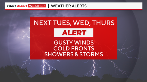
NORTH TEXAS – Three first alerts are now in place for next week. Details may still change, but we will discuss the latest trends and my thoughts below.
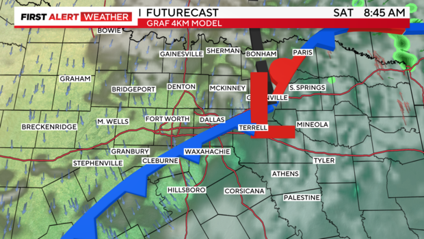
First, a weak frontal boundary is moving through now, and you should feel a slight difference Saturday morning with drier air filtering in.
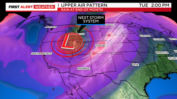
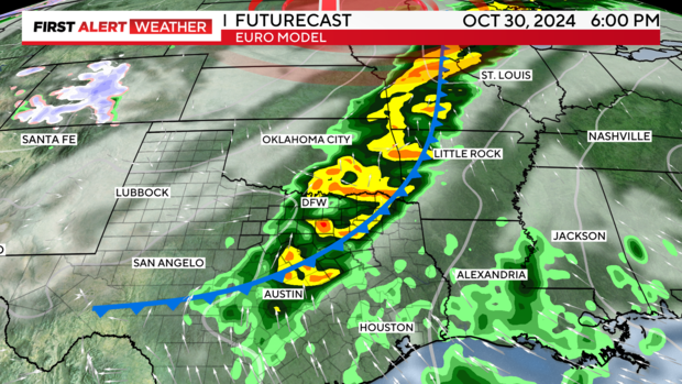
NEXT WEEK: At upper levels, a powerful jet stream trough will dig over the Rockies and eject energy over the central and southern plains by midweek. Models have been slightly more progressive in trends, leading to a late Tuesday into Wednesday morning arrival for activity in North Texas. We shall see. Either way, expect higher winds Tuesday before bigger changes Wednesday.
WEDNESDAY: Either beginning late Tuesday (American model) or early Wednesday (Euro model), widespread showers and storms are expected in our DMA. The Euro model is now trending slightly later, with a chance of more organized storms, including the possibility of a few strong to severe ones. If there's enough instability late Wednesday, a few storms with heavy winds could occur. The frontal passage looks pronounced through Thursday morning, dropping our temperatures and humidity nicely.
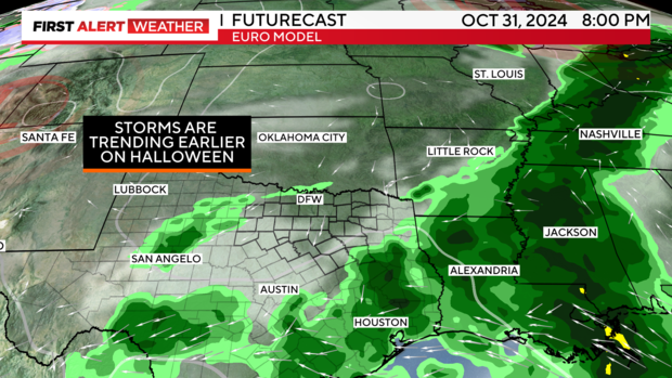
Halloween: Timing can still fluctuate, but the current trend has the first powerful front and leftover activity from Wednesday exiting the region by midday Thursday or a little later. This would be great news for trick-or-treaters and Halloween! Fingers crossed this holds…
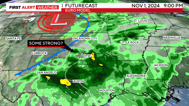
FRIDAY into NEXT WEEKEND: There's more uncertainty in this time period because we're a week out. However, one major model (Euro) has been trending toward heavy rain and another frontal passage. If this occurs in the afternoon to evening hours, there's an outside chance of a severe threat as well. If this model trend continues into next week, we'll need to watch for the threat of heavy rainfall next weekend. Precipitable water levels (a measure of the amount of water the atmosphere holds) are projected to be very high, so any storms that stall or sit over our DMA will have heavier rainfall amounts.
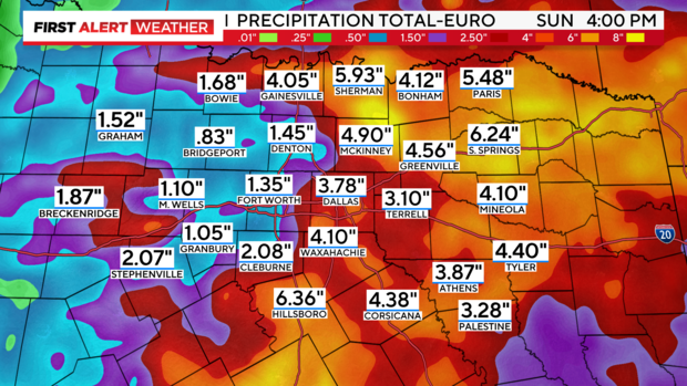
Thus, the Euro model is projecting these rainfall amounts by next Sunday. Right now, this seems to be on the high end, but we'll need to see where the model trends take us by early next week. I am mentioning on-air and to you now, to "not take these numbers to heart." Plenty can fluctuate, but I show this to offer a possibility of what could happen and where this major model is trending. Of note: the American model is much more progressive and leaves us drier for next weekend.
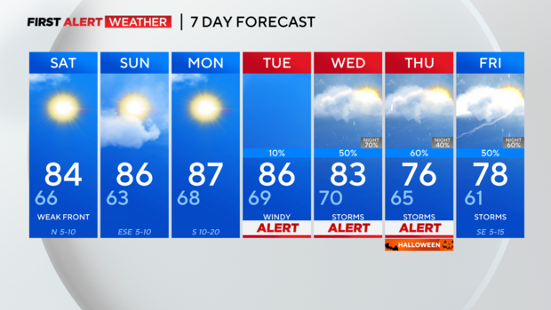
7-day: