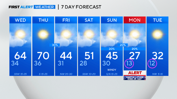
Wednesday, Thursday come with a brief warm-up before a cold front slides in
NORTH TEXAS - There is another cold morning ahead, a couple of warm days, and another round of rain/storms early Friday as it turns colder again.
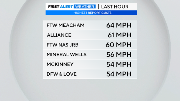
Winds Monday night and overnight were brutal. Wind chills this morning bottomed out in the low 20s. Below are the highest reported gusts. These are straight-line winds NOT from a storm. Severe weather wind criteria from thunderstorms start at 58mph. We had gusts above that last night.
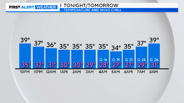
Tuesday evening the winds rapidly die down. They'll pick right back before daybreak on Wednesday; however, it happens just as temperatures again drop in the mid-30s. Wind chills are right back down in the 20s.
Strong winds Wednesday will be out of the southwest, a warming wind. Highs will skyrocket into the low 60s. A strong south wind on Thursday pushes the highs to the 70s!
I don't think it'll be that warm again for a couple of weeks after. Another show of cold air arrives that morning, dropping temperatures through the day.
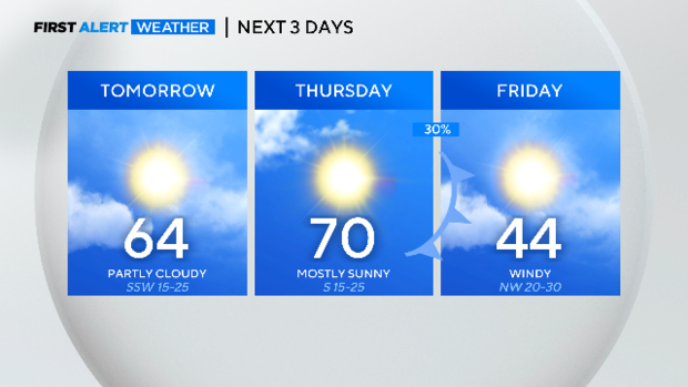
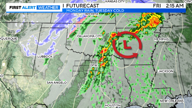
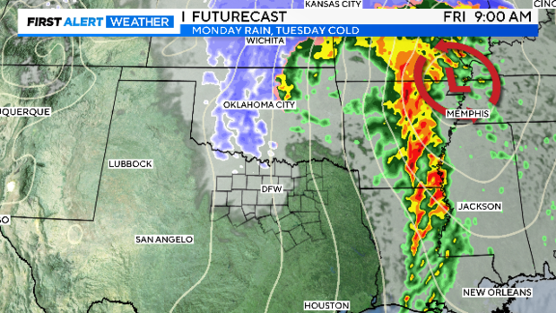
We are forecasting storms in the early morning hours of Friday, before the morning commute. There is a small chance they could even be severe with damaging winds and small hail. As temperatures drop, a few flurries are even possible as the storm pulls away and wind howls out of the northwest.
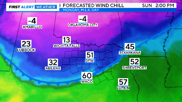
On Sunday afternoon another front arrives. This one brings a direct shot of arctic air and the coldest temperatures so far this winter.
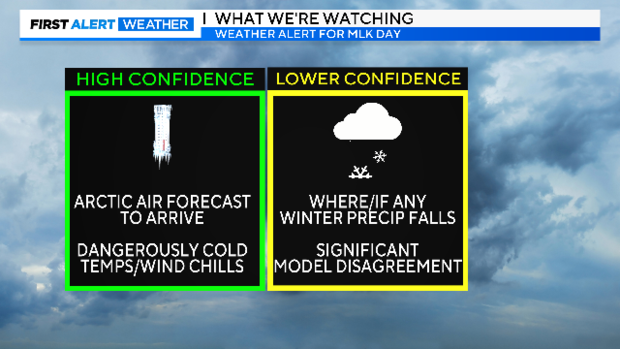
A weather alert is issued for this coming Monday, Jan. 15, due to dangerously low wind chills and a possibility of snow.
We have high certainty there will be dangerously low wind chills that morning, below zero, in fact. Less certain is the track of the storm and if we'll see any snow from this system. We'll keep you posted.
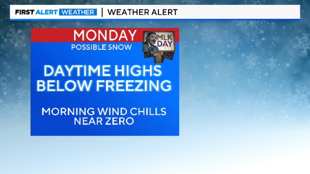
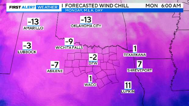
The temperatures will start to drop Sunday afternoon. We expect to stay below freezing all day on Monday with powerful north winds producing single-digit wind chills most of the day.
The First Alert Weather Team will continue to provide daily updates on this forecast as we approach Monday. There is even a chance we could alert for the weather we are expecting before that on Thursday night and Friday. We are in a very active weather pattern right now and forecasts, especially ones that involve snow, can change quickly. Stay posted…PLEASE. There is some dangerous cold headed our way.
Here is your 7-day forecast: