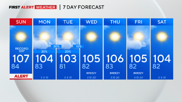
Weather Alert Sunday due to Excessive Heat Warning
NORTH TEXAS (CBSNewsTexas.com) - It will be another dangerously hot day Sunday with a heat index over 110° in the afternoon. Some rain chances show up Monday and Tuesday though!
The 100-day count continues to increase.
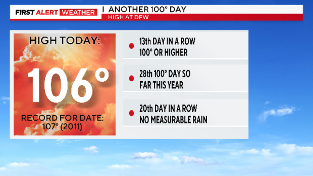
The high came within one degree of tying a record for the date set back in the hottest summer on record, 2011. It was however the fifth day in a row where the high hit 105° or higher.
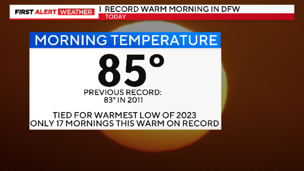
We did break a record Saturday with the low in the morning only getting down to 85°.
This is the 2nd time this summer the low was 85°. To put this in perspective on how rare this is to be this warm in the morning, there are only 17 mornings in our records where the morning was that warm or warmer.
A very hot day again on Sunday with a Weather Alert as the heat index will again approach 110° or higher.
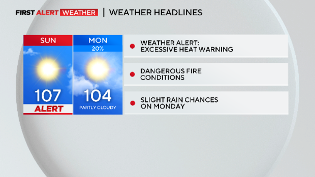
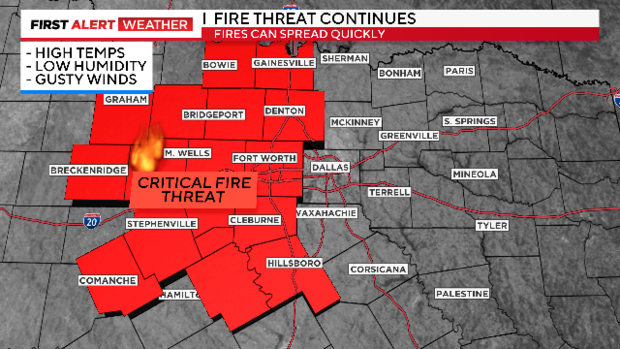
There is also a dangerous fire risk again Sunday.
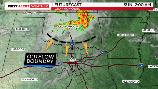
Overnight storms moving across Oklahoma Sunday night will kick out an outflow boundary. By Sunday afternoon, that boundary will be over North Texas and could trigger some afternoon storms. This happened today over Montague and Wise counties so it could happen again Sunday.
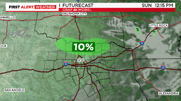
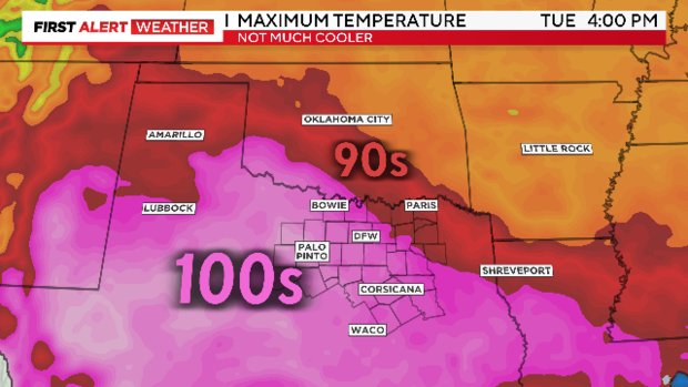
The heat dome shifts a little west to start the week which opens the door to more storms streaming down from the northwest over the next couple of days. This allows some cooler air to cross the Red River and knock down our temperatures just a hair.
It's not much, but at least it's a little relief and a little bit of a rain chance. As soon as the rain chance leaves starting Wednesday we are right back to more dry and hot days.