Weak cold front is headed for North Texas
NORTH TEXAS — Severe thunderstorms are occurring in the Texas Panhandle, even a few radar-indicated tornado warnings. It almost officially seems like Fall, which begins Sunday at 7:43 a.m.
Remember, as we transition into the Northern Hemisphere's autumnal equinox and eventually towards the next solstice, we continually lose daylight daily, while the Southern Hemisphere gains daylight.
This is separate from Earth's transition to perihelion, or the closest bodily proximity to the sun. The earth is at perihelion during our Winter Solstice and the Southern Hemisphere's Summer.
Our summer solstice, when the Northern Hemisphere is tilted towards the sun, is also when earth is at its farthest point from the sun or aphelion. This is also why the UV Index will usually top out around 16 in Australia versus around 12 for us, assuming comparable latitudinal distances from the equator and elevations.
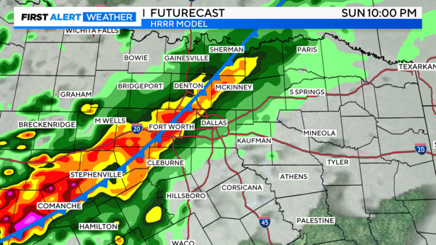
Finally, another weak frontal boundary approaches the metroplex late Sunday along with showers and storms. Not a bad drop.
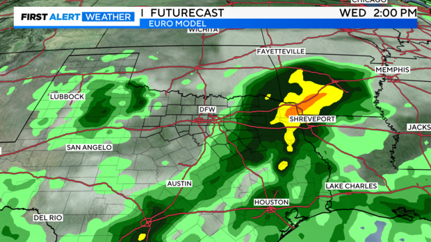
High-resolution models still bring this all in from the afternoon through the late evening hours. Low-end severe threat with these. A marginal severe warning or two for wind/hail can't be ruled out.
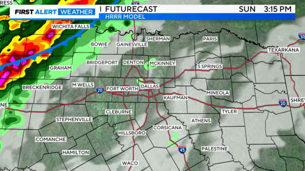
This is trending a bit behind and shows activity late. Nonetheless, it gives us an idea of what to expect.
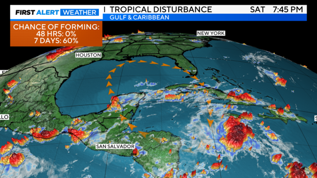
Now, the Tropics...
The National Hurricane Center gives this a medium chance of formation through the next week. The European ensemble model guidance continues to suggest that Tropical Storm Helene will form late next week, if not a hurricane. Buoys are still reading very warm sea surface temperatures in the Gulf, so this bears watching. Still way too far out to estimate a track, but the loose consensus right now appears to be a track heading towards the north or eastern Gulf. We'll see.
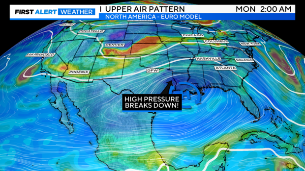
Our pattern
Positive changes are taking place, finally.
First, our oppressive high-pressure ridge slides southeast and breaks down. Second, a large dip in the jet stream should dive south from Canada over the next few days and usher in more unsettled weather, meaning rain and storm chances along with cooler air.
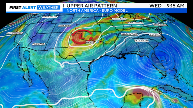
Late next week, the track of Helene could come into play and interact with the mid-to-upper low pressure over us and keep unsettled weather over the southern plains and the southeast into the following weekend. There's so much uncertainty here, but this is an interesting trend showing up in guidance.
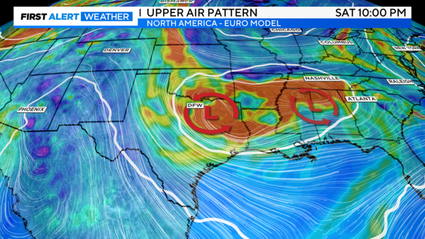
Here's the long-term European model guidance for next week. Don't take any of these images to heart, but it gives a general idea of just how unsettled we'll be with multiple days of rain chances and cooler air. One thing's for sure: we won't be as hot.
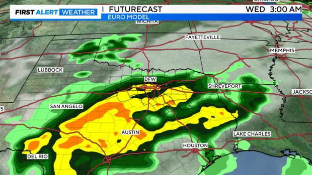
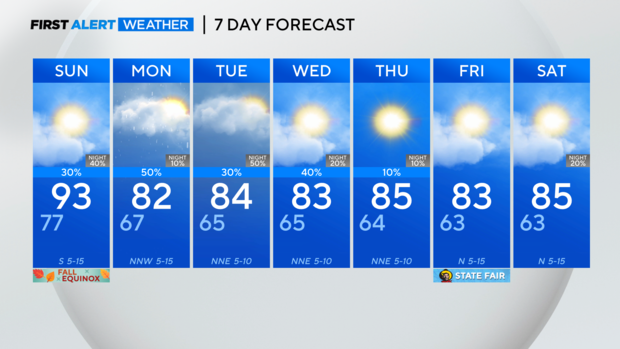
Seven-day forecast: due to the multiple pattern changes at upper levels and ample moisture present over us, I've kept rain chances in through most of the week. At this point, Sunday night into Monday and Tuesday night into Wednesday appear to have the best chances, however.