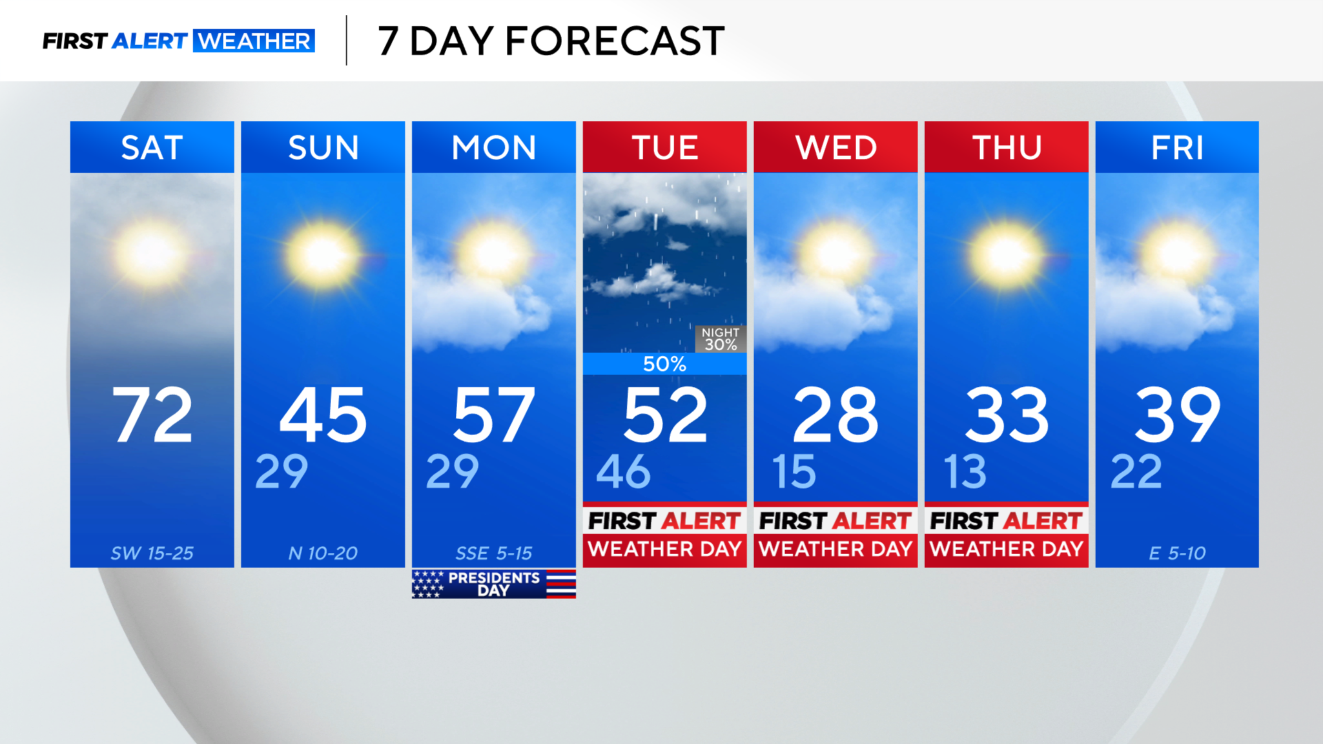
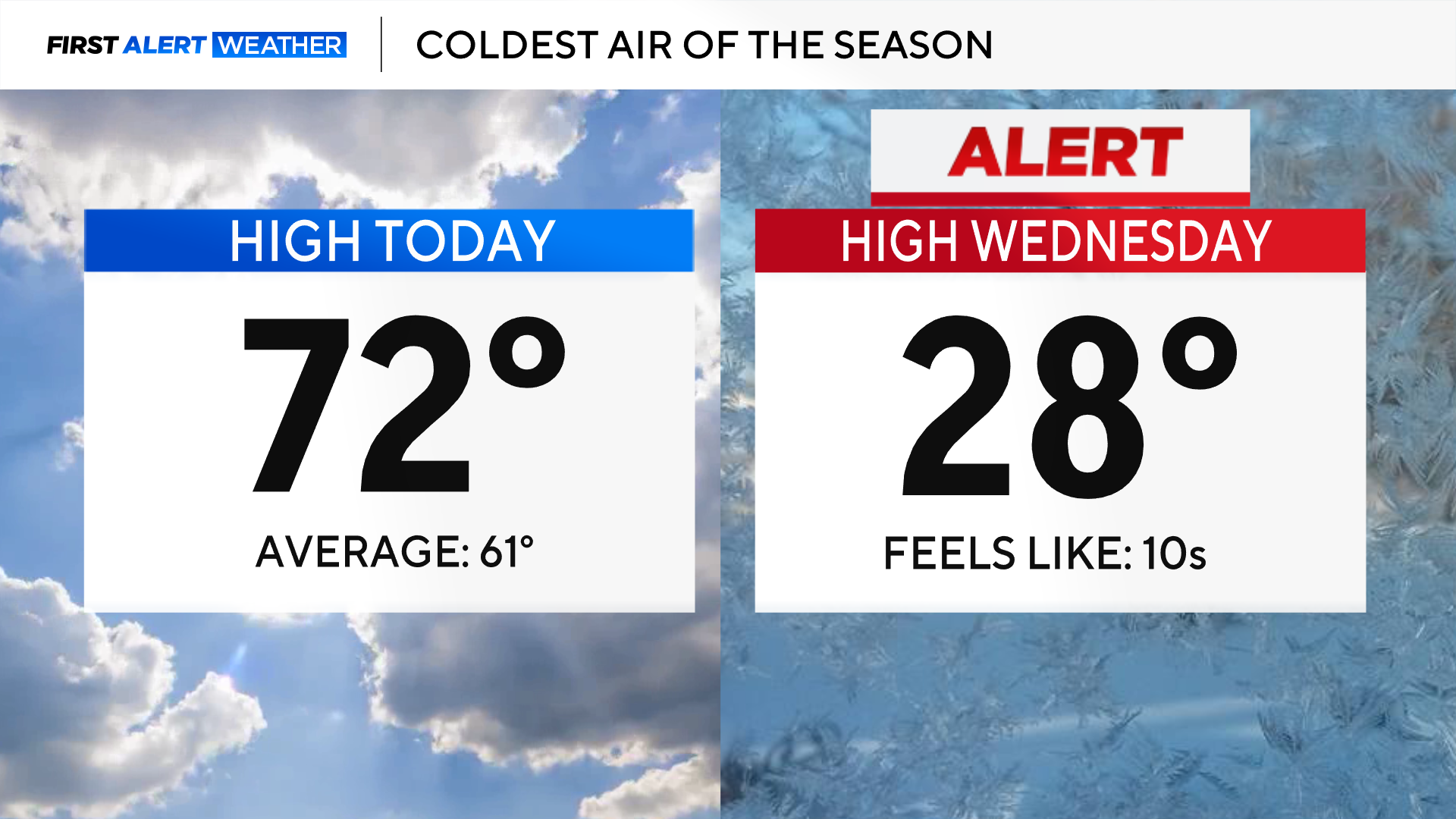
Warm Saturday turns chilly as North Texas braces for icy cold front
Fog has developed across North Texas, sometimes dropping visibilities under a mile.
Drivers should use caution on the roadways this morning.
Mist and drizzle accompany an already grey morning, but sunshine will return this afternoon as a cold front moves into the area.
Strong southerly winds will boost temperatures to near 72 degrees ahead of the front.
For those heading out this evening, grab the jacket, as temperatures will quickly tumble behind the front around 4 p.m.

Temperatures will drop into the 20s overnight, but it will feel like the teens Sunday morning.
Cold air continues to spill into North Texas on Sunday, despite the sunshine keeping highs in the mid 40s.
If a morning in the 20s sounds cold, just wait until Wednesday - when afternoon temperatures struggle to reach the upper 20s.
Tuesday, Wednesday, and Thursday are First Alert Weather days due to the potential for a light wintry mix followed by dangerously cold temperatures.
The next system moves in on Tuesday, first bringing rain showers to the area. During the evening hours, an arctic front moves in, causing temperatures to plummet below freezing.
There may be a brief changeover to light freezing rain before the precipitation ends around sunrise Wednesday morning.
The light freezing rain could impact travel, especially on bridges and overpasses.
Even if there is no freezing rain, any surface that is wet from Tuesday's rain will freeze overnight, leading to icy spots for the morning drive on Wednesday.
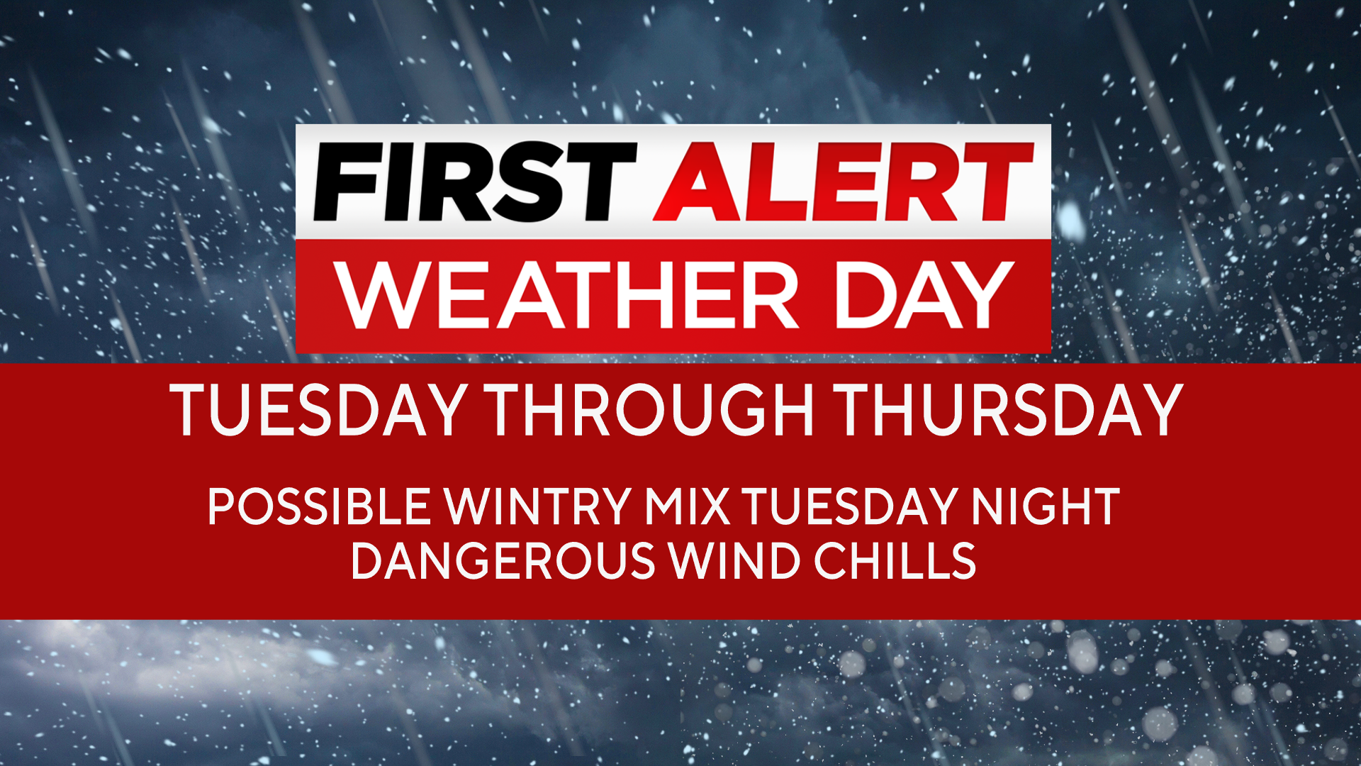
The dangerous cold sets in Tuesday night, and temperatures in the teens will set in on Wednesday, with wind chills below zero in some spots.
Thursday will be a repeat with subzero morning wind chills and highs barely reaching freezing in the afternoon.
Breezy, northerly winds will keep temperatures feeling like the teens both afternoons.
Please prepare for cold weather by Tuesday, ahead of the coldest air this season.