Warm, breezy, cloudy Easter Sunday in North Texas
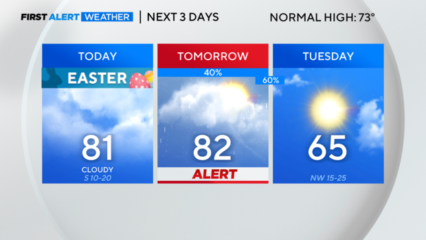
NORTH TEXAS — This morning is off to a mild start, perfect for all the Easter activities! Temperatures will climb from the mid 60s this morning into the lower 80s this afternoon.
Breezy southerly winds will continue to draw gulf moisture north into the area making it feel muggy.

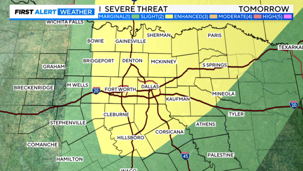
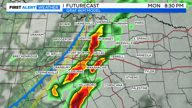
A weather alert is in place for Monday afternoon/evening as we are tracking the potential for strong to severe storms. North Texas is under a level 2, slight risk, of severe storms capable of large hail and damaging winds. The tornado threat is low but not a zero and increases for areas along the Red River.
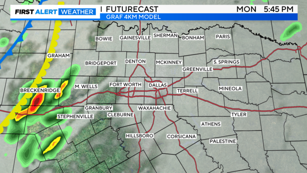
A modest cap will be in place for most of the day. But a dryline and cold front to the west are expected to erode the cap by late afternoon prompting storm development. Not everyone will see the storms, but please remain weather aware as any storms may quickly become severe.
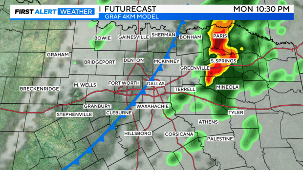
A cold front sweeps through behind the storms shifting our winds northerly and returning cooler air to the region. The sunshine is also back Tuesday with highs only in the mid 60s. Keep the jackets handy as we start off in the mid 40s Wednesday and Thursday.
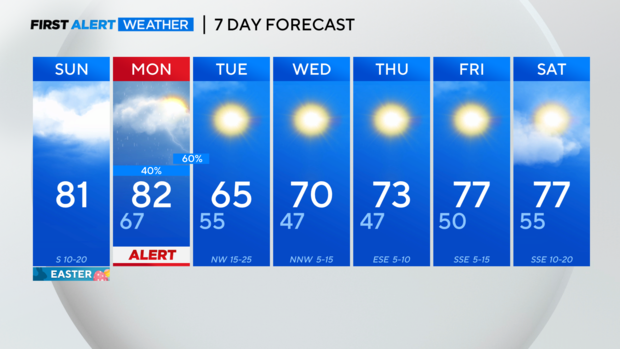
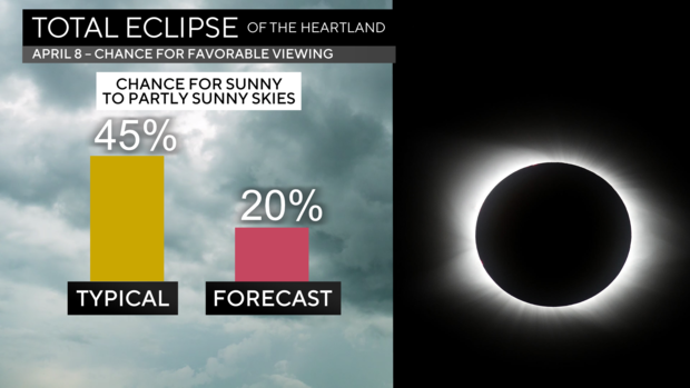
We are keeping a close eye on the forecast for Eclipse day. Unfortunately, it is looking cloudy with the potential for rain. Right now, rain chances increase after totality. It is still over a week away, so the forecast can change.