Tropical Storm Nicholas Continues Trek Toward Texas Gulf Coast
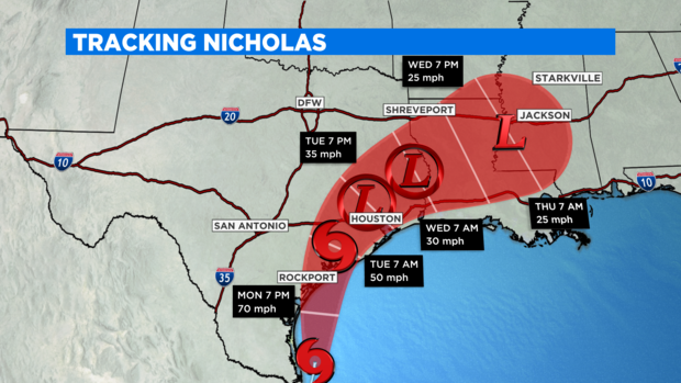
NORTH TEXAS (CBSDFW.COM) — The forecast track of Tropical Storm Nicholas continues to show landfall Tuesday morning somewhere near the Palacios/Port Lavaca area along the Texas Gulf Coast, with winds near 70mph.
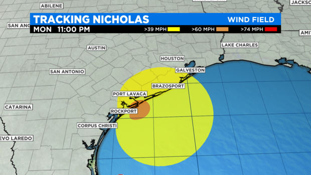
There is a slim chance Nicholas could even briefly become a Category One hurricane (74mph sustained winds) before making coming onshore and weakening.
The current track puts the highest storm surge (up to 4-5ft) and strongest onshore winds between Port Lavaca and Galveston tonight and tomorrow early. This is the most likely area of damage from the storm.
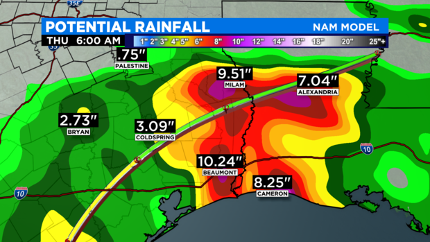
Flooding is a major threat with Nicholas as it comes on shore and dumps its' tropical rains over the Texas coastal region. Some areas could get more than a foot of rain. Much of this depends on how fast the storm is moving as it hooks east into Louisiana over the next two days.
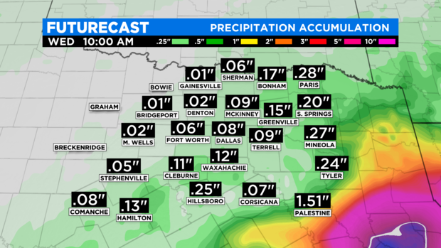
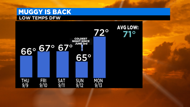
The impacts for North Texas from Nicholas continue to look low. The highest potential for significant rain will be across our southeast counties over the next few days. Dewpoints rose significantly overnight as muggy, tropical air now envelopes our area. This is best reflected in the overnight low. Just yesterday morning we DFW logged the coldest morning since early June. THIS morning the low was more typical, in the low 70s teamed with low clouds.
Rain chances stay relatively small for the Metroplex over the next couple of days as Nicholas passes to our southeast. The clouds should hold temperatures down into the 80's. As soon as the storm moves far enough east as it unwinds over Mississippi sunshine and 90s return to north Texas. Next weekend looks like yet another one with summer temperatures. Still waiting for some fall weather!
