Thunderstorms stick around another day before sunshine and heat return
NORTH TEXAS – North Texans will experience one more day of thunderstorms before an entirely new weather pattern starts on Wednesday.
Thunderstorms in West Texas on Tuesday morning will gradually move east and impact the Dallas-Fort Worth area mainly in the afternoon and early evening hours. By sunset, the storms are expected to move down into central Texas.
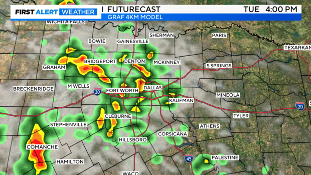
Heavy rain and the threat for flooding is the greatest concern with Tuesday's storms, but a few neighborhoods could also see hail and damaging winds, especially southwest of Fort Worth.
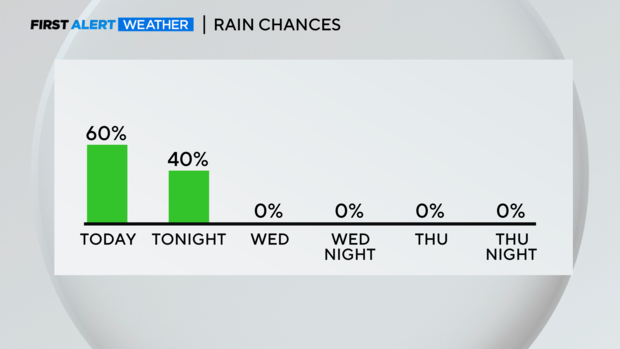
After storms move out Tuesday night, North Texas enters another stretch of clear skies and zero rain.
Meanwhile, temperatures will stay below normal again for the second week in June but an abundance of humidity will continue to make it feel very warm.
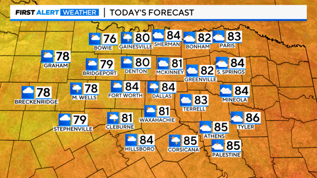
Air temperatures will be in the 80s, but the heat index will make temperatures feel well into the 90s.
A heat dome moving across the country will crank up temperatures heading into the weekend.
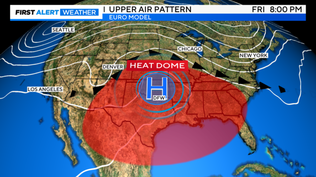
Once the new weather pattern takes over on Wednesday, North Texans will experience a long stretch of mostly sunny, dry and hot weather that will continue through Father's Day weekend.
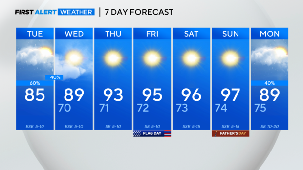
Small rain chances return early next week.