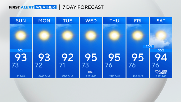
The heat strikes back in North Texas
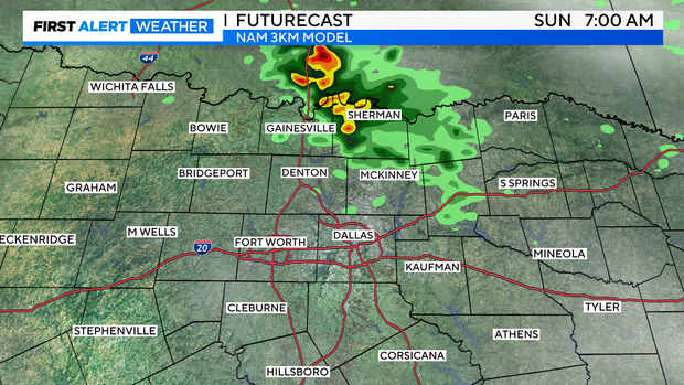
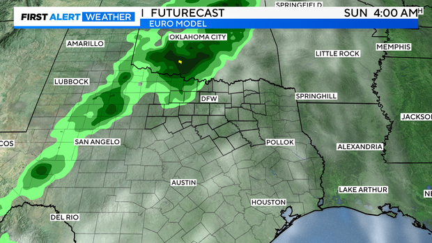
NORTH TEXAS - First, another northerly-flow disturbance at mid-levels should produce convection over southern Oklahoma overnight and slide into North Texas early tomorrow morning. Some storms could have downburst winds and lightning. Denton and Collin counties could get lucky and see some of this activity. We would love to see it! A stray storm or two is possible in our far northwestern DMA late in the afternoon, but we'll see if this verifies.
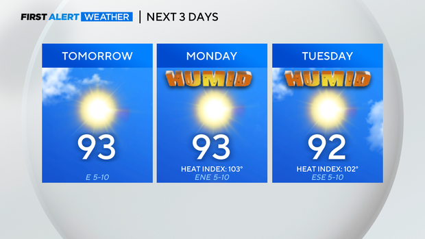
It'll be a muggy and warmer start to your Sunday AM.
And, just what you wanted to see:
Heat indices should get pretty uncomfortable to start the week.
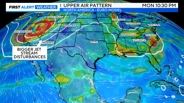
Now, as we descend into fall, we'll begin to see the upper-level jet stream dip farther and farther south. Synoptically, this puts us back into a 'mini' fall severe weather season pattern. But while we're still a few weeks away from really being in that climatological peak, we'll continue to see this; more troughs digging deeper over the lower 48.
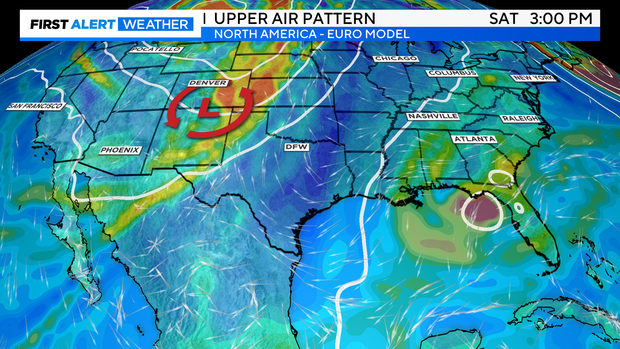
Next weekend, we should see a powerful trough dig over the four corners region and then rise over the central plains. This will likely begin a more active pattern for us to round out the subsequent few weeks and the month. Still too far out to determine specifics, but perhaps even a surface front next weekend with some thunderstorm chances. Hallelujah.
Hot.
Have a good weekend!
Go 'Boys & Chiefs!