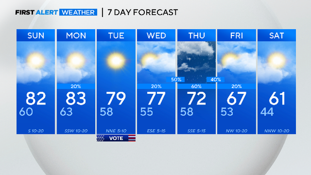
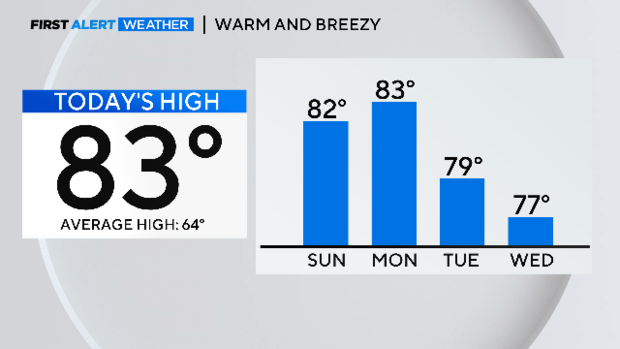
Temps return to the 80s Sunday, rain chances return Monday
NORTH TEXAS - Just like that, ate spring weather is back. It was just two days ago we had a high worthy of mid-winter.
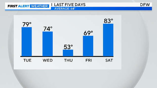
We just finished with the third warmest February on record. Very warm days start Saturday and stick around for most of the week ahead.
There are some rain chances ahead. Over the last three weeks, DFW has logged only .06" of rain. Going into spring, you'd like to see more rain. Monday evening we could have a few strong storms, especially in our eastern counties.
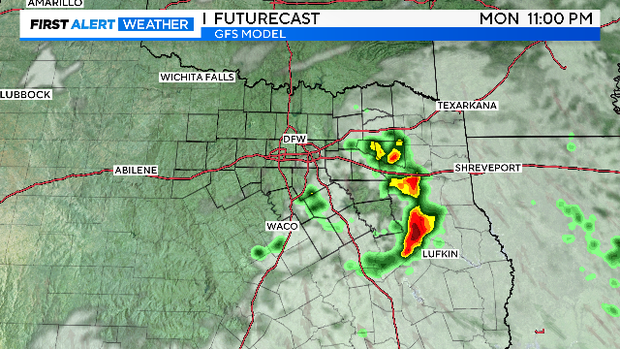
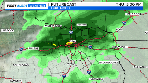
These storms could produce large hail and damaging winds. The better chance of rain waits until Thursday. We again could see some storms but it is too early to assess the severe threat on that day.
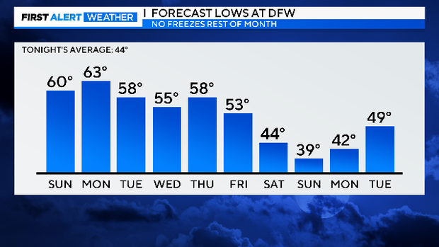
A front arrives on Friday and brings much cooler temperatures. We could start next weekend in the 30s Saturday morning. There is no freeze in the forecast. The last one at DFW was 13 days ago, the average last freeze is March 12.
The largest wildfire in Texas history continues to burn out in the Panhandle. Red Flag warnings were in effect Saturday and continue Sunday for the burn area which is just terrible news. The fire has already burned 1,700 square miles.
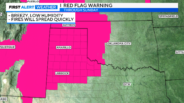
We continue to monitor the elevated fire threat in our western counties in North Texas. The rain mid-week will help.