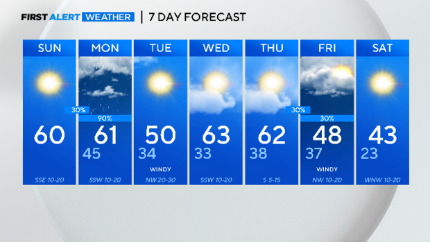
Temps near freezing ahead of a warm afternoon
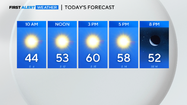
NORTH TEXAS - It is a cold morning with temperatures around the freezing mark in North Texas. We are starting off with clear skies and they will remain that way all day long, so keep the sunglasses handy! Temperatures are back to near 60 degrees this afternoon due to breezy southerly winds.
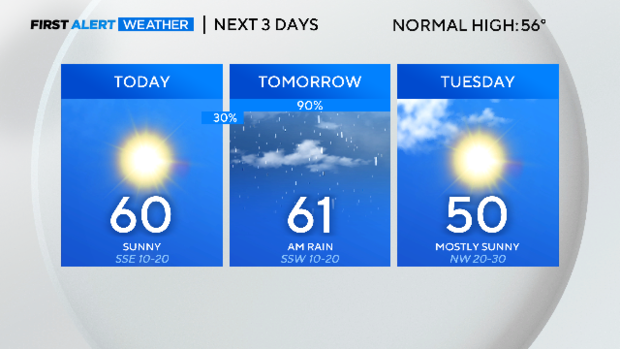
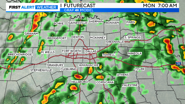
Then dig out the rain gear for Monday. Gulf moisture will continue to stream in overnight and showers will develop by early Monday morning.
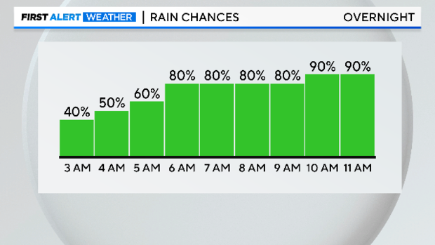
Plan for a slower morning commute with rain and a few storms around as you head off to work and school tomorrow. The severe threat is low but some gusty winds are possible with any stronger storm.
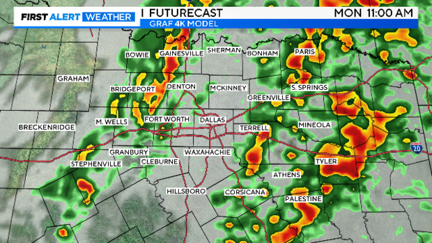
You will want the rain gear if you are headed out to lunch, we will still be tracking rain and storms on First Alert Radar.
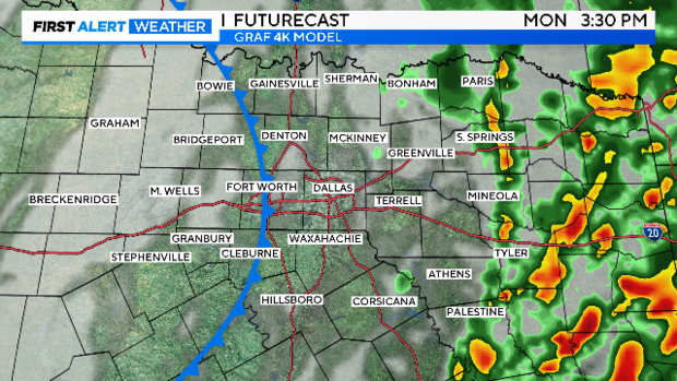
Precipitation ends from west to east heading into the afternoon hours followed by a strong cold front.
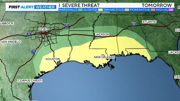
The severe threat is low for North Texas and mainly focused along the Gulf coast where tornadoes and damaging winds are possible.
You will know when the cold front arrives! Strong northerly winds move in behind it with gusts near 40 mph and sustained winds 20-30 mph.
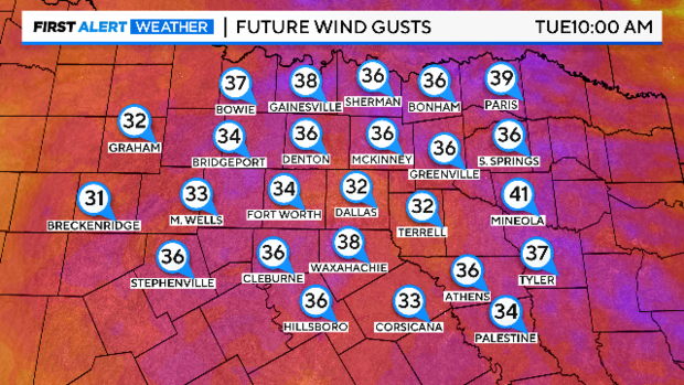
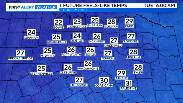
Those strong winds mixed with colder air moving in mean we wake up to wind chills in the 20s Tuesday morning! Bundle the kids up as you send them off to school as winds remain strong all day.
Our cool down is brief with southerly winds and sunshine Wednesday and Thursday, bumping temperatures back into the 60s. Then, get ready for arctic air! We are alerting you to the coldest air of the season Friday into Saturday. Overnight lows drop into the 20s and afternoon highs top out in the lower 40s. You will want to make cold weather preparations with the cold air sticking with us through mid-January.