Temperatures back to the 90s; rain chances for North Texas return midweek
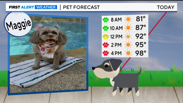
NORTH TEXAS — Great news for the pups and humans alike, we are getting a break from the oppressive heat.
Our pattern is changing as the heat dome shifts to the northeast, allowing us to get closer to normal summer conditions.
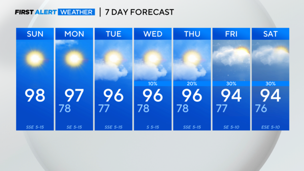
We are tracking an area of low pressure in the Gulf headed to South Texas. It will bring rain chances to North Texas starting Wednesday into Thursday, but any rain will be scattered and likely focused south of I-20.
Clouds will be thicker in DFW helping to keep temperatures down a bit even as humidity increases.
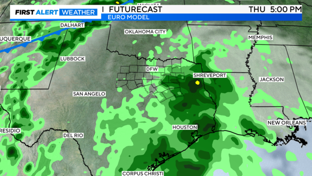
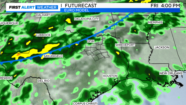
Better rain chances arrive later this week with a cold front headed our way.
There is a bit of a timing difference between the models, with the European Model below, bringing the front in Friday evening into Saturday with decent rain.
The GFS is a little later in the weekend, with more scattered showers.
The First Alert Weather Team is keeping a close eye on this potential threat of showers.
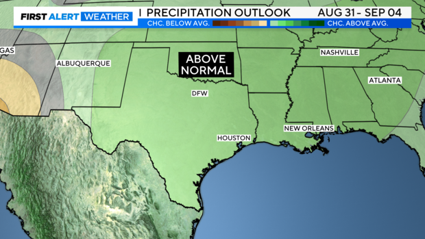
Looking ahead to the first week of September, the Climate Prediction Center is forecasting above-normal precipitation.
The First Alert 7-day forecast is looking significantly more tolerable.
We are back to the mid-90s where we should be for this time of year, headed into the weekend.