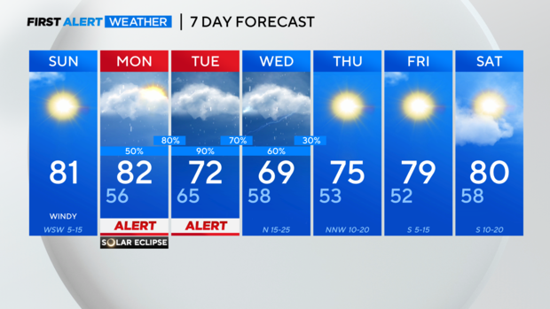
Sunshine and warm temps in North Texas for your Sunday forecast
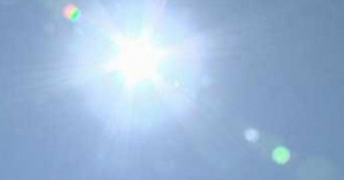
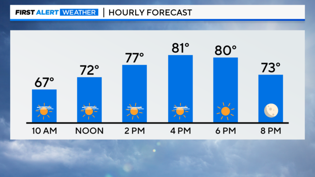
NORTH TEXAS — We have a gorgeous day ahead with lots of sunshine, a light breeze and temperatures warming into the lower 80s. It's a perfect day for exploring Texas!
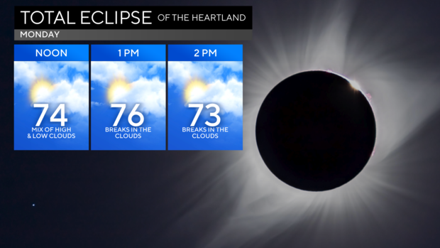
Good news on the cloud cover forecast for Eclipse viewing tomorrow, high clouds are expected to be thinner than previously forecast and there will be breaks in the low clouds that move into North Texas! Keep in mind, there will still be cloud cover in the area during the event that may obscure viewing depending on your location. Even with the cloud cover we will still experience darkness.
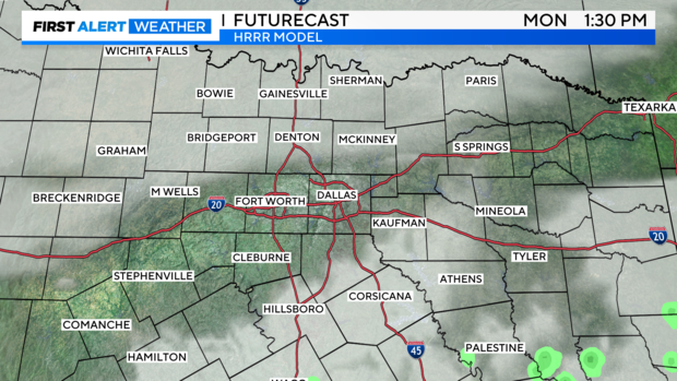
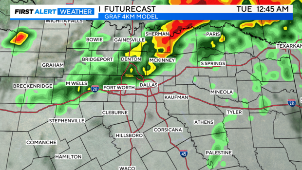
Following the Eclipse please be weather aware. Storms will begin to develop in as little as 1-2 hours after the event, especially southeast of DFW.
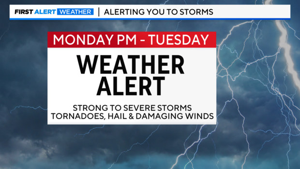
Make your plans now for where you will seek shelter if a storm heads your way and have multiple ways of receiving warning information. The main threat with Monday evening storms is large hail to the size of golf balls, but tornadoes and damaging winds are also possible.
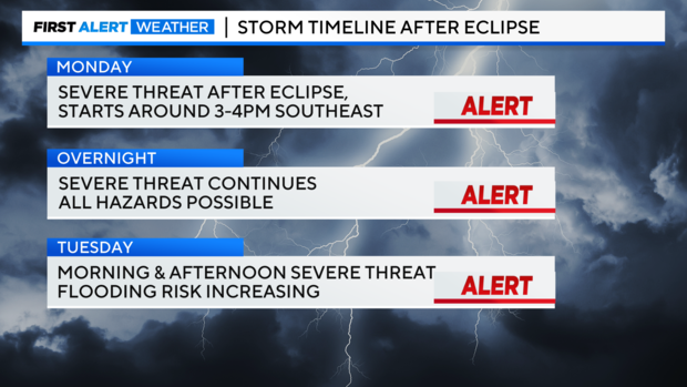
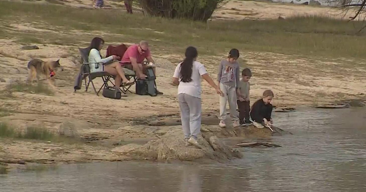
If you are camping Monday night, you are encouraged to move into a sturdy structure as it is going to be an active night and you may only have a few minutes to seek shelter. Storm coverage will increase through the evening hours especially east of I-35.
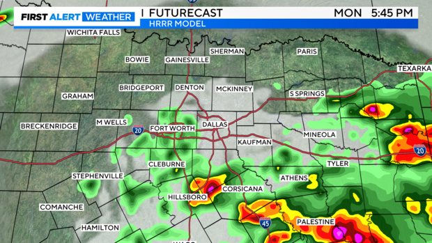
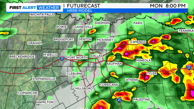
Then as we near midnight another line of storms will likely move in from the northwest and track east through the Metroplex, with the greatest risk north of I-20.
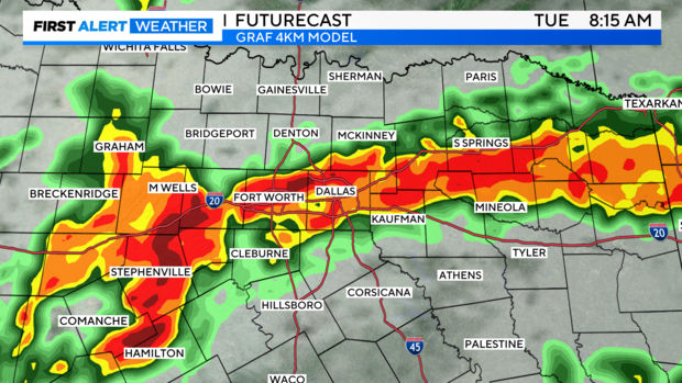
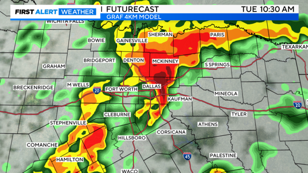
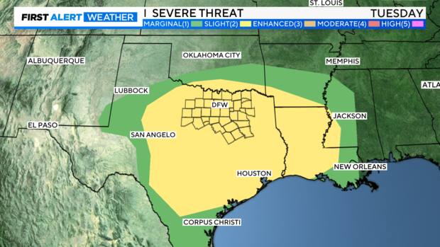
Travel is going to be rough on Tuesday as another round moves into the Metroplex around daybreak. Storms will likely continue into the midday hours before a brief lull in activity. Severe storms capable of large hail, damaging winds, tornadoes, and localized flooding are all possible.
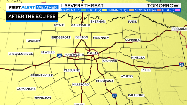
The Storm Prediction Center has all of North Texas under a level 2, Slight Risk, for both Monday after the Eclipse and all day Tuesday.
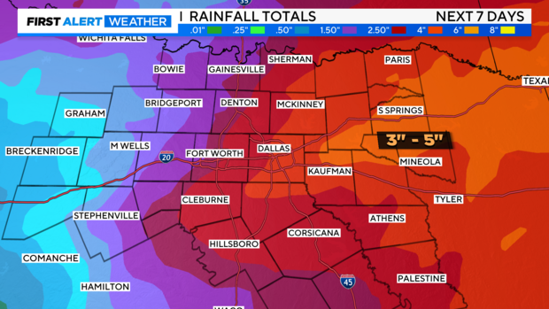
The flooding threat will increase by Tuesday evening and peak heading into Wednesday with yet another round of heavy rain. The highest rainfall totals of 3"-5" are expected east of I-35, with the Metroplex picking up 1"-3" of rain and lesser amounts to the west. Locally, higher amounts are possible where training of thunderstorms occurs. Please remember Turn Around, Don't Drown. Never try to drive through water covered roadways as you don't know how deep the water is and you could put yourself in a life-threatening situation.
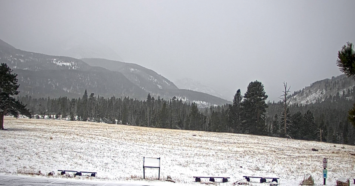
After the system clears out Wednesday night, we have a tranquil few days with sunny skies and warming temperatures.
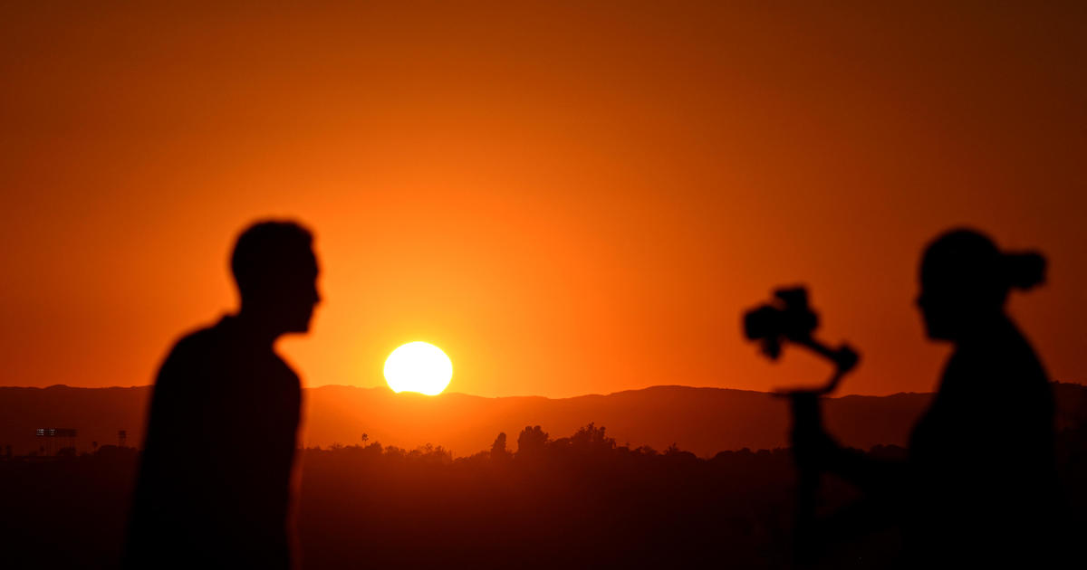
Please be safe over the next few days. Wear your eclipse glasses to protect your eyes and remain vigilant to the changing weather. The First Alert Weather Team will keep you updated on the forecast and be with you through all of the storms.