Sunny, warm Friday across North Texas
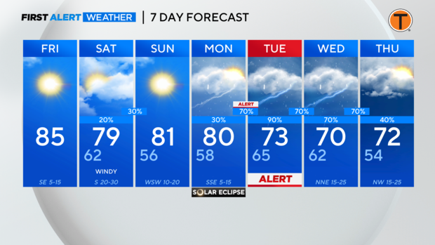
NORTH TEXAS — As we move through this Friday, expect another warm day. Highs will be in the mid 80s this afternoon under mostly sunny skies. Tonight, skies will become partly to mostly cloudy. Low temperatures will be in the low 60s.
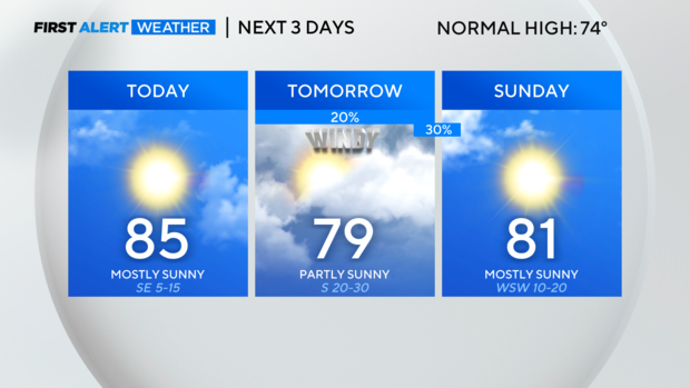
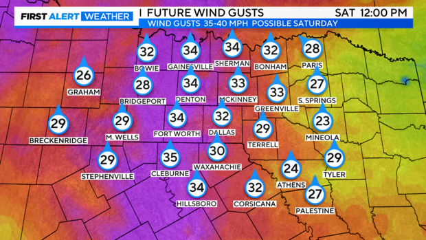
On Saturday, hold on to your hats! It will be windy Saturday, with winds gusting from the south up to 35-40 mph. Highs will climb into the upper 70s under partly sunny skies.
A cold front will push through the area late Saturday night, giving way to a couple of late night showers and storms. The threat for severe storms is lower now. Still, a couple of strong storms are possible Saturday evening and night as the front crosses North Texas. If storms develop, they're capable of producing frequent lightning, gusty winds and potentially some small hail.
With the front to our east by Sunday, we'll see mostly sunny skies with highs in the low 80s.
Let's talk about the Total Solar Eclipse on Monday!
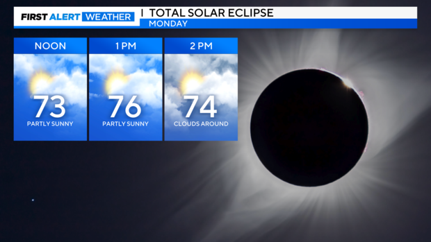
Our forecast models continue to call for partly to mostly cloudy skies over North Texas as we head toward totality early Monday afternoon.
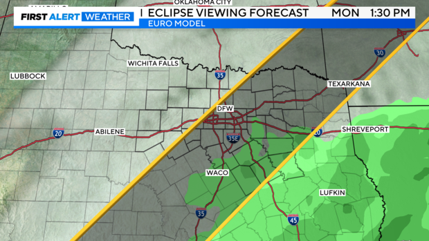
In fact, we'll likely see high clouds over our skies during totality. Temperatures will be in the 70s early Monday afternoon.
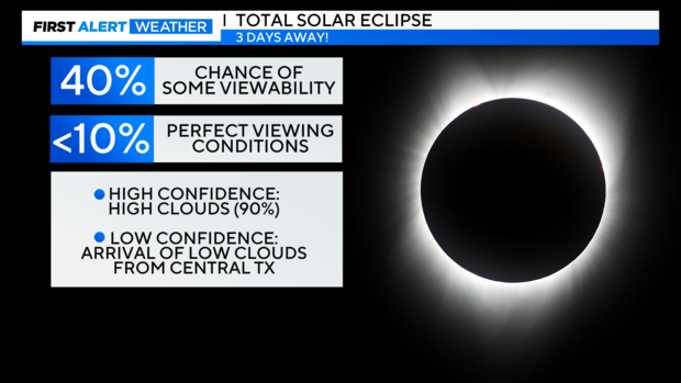
Low to mid level clouds will likely creep in later in the the afternoon and evening, but the arrival time of those clouds is still in question. However, when the clouds arrive, they will give way to showers and storms. Some of those storms could be strong to severe.
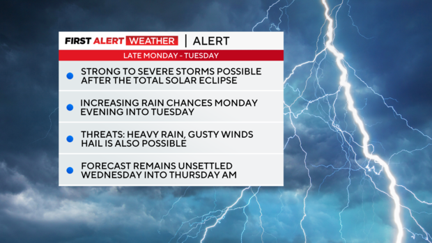
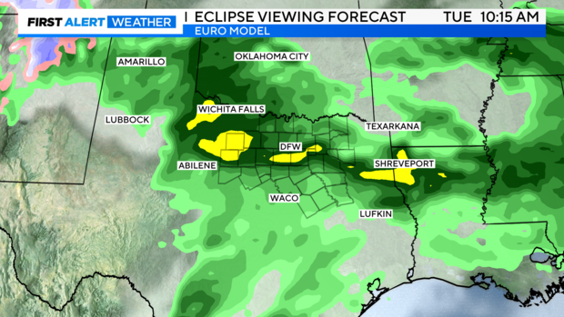
That's why we've posted a Weather Alert for late Monday through Tuesday. This Weather Alert will go into effect AFTER the Total Solar Eclipse.
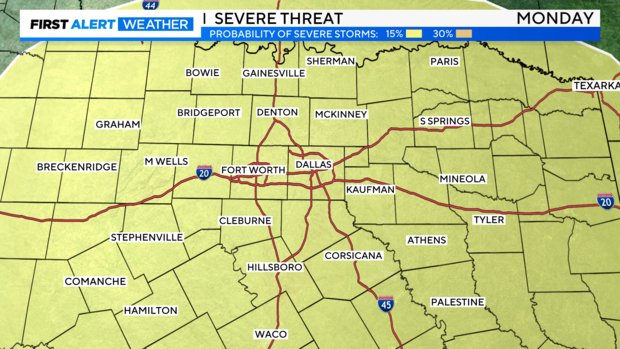
The storms that will roll in will be capable of producing heavy rain, gusty winds, hail and localized flooding. We can't rule out an isolated tornado, but that threat is low for now.

So, prepare for widespread rain at times on Tuesday. Highs will be in the lower 70s.
Unsettled weather will continue through Wednesday and Thursday morning with showers and storms.