Sunday cold front brings chance for showers
NORTH TEXAS (CBSNewsTexas.com) - We tied Friday's high of 110° on Saturday. It was a record high, shattering the old one of 106°, and is the first time it's been at 110° or higher two days in a row since 1980.
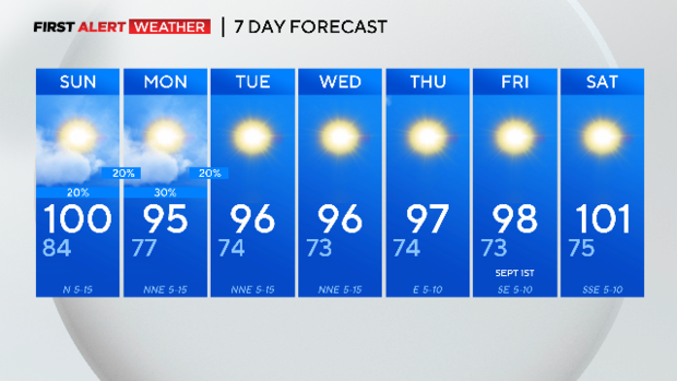
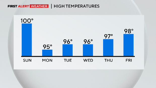
The next time DFW hits 100°, which could happen Sunday, we will match last year's count of 47 days at 100° or higher, sixth on the list.
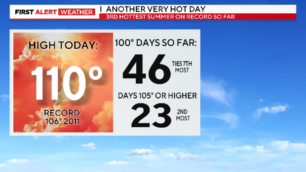
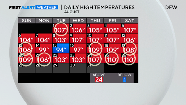
It's the third hottest summer on record with five days left in the month. Of the last eight days, DFW hit a new record high on six of them. This is the hottest August on record.
We saw some decent coverage of afternoon storms again on Saturday with better coverage than Friday. None of it got near the DFW airport or even inside the Metroplex as of 6 p.m.
The dry spell continues at 41 days since the last measurable rain. The last time DFW logged at least one inch of rain was 122 days ago, or four months.
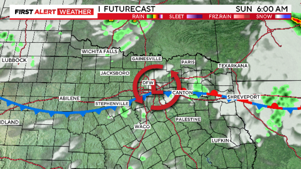
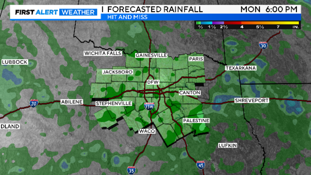
We are expecting the front and a low-pressure system to move right over us on Sunday morning, meaning a north wind with drier air. We might still hit 100° at the airport and there is only a 20% chance the airport will get some rain.
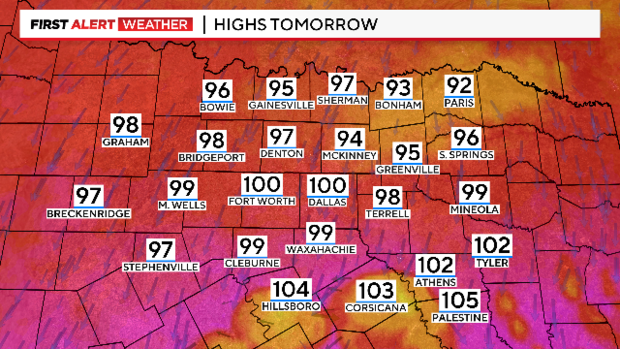
Highs on Sunday will still be in the heat advisory range across Johnson, Ellis and Kaufman counties. There is a heat warning
for our southeast counties.
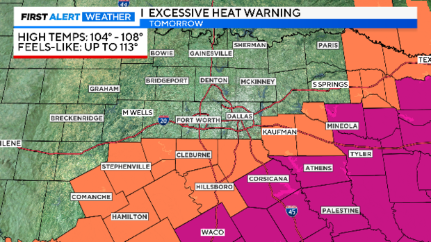
While highs will be in the low 90s along the Red River, the heat and humidity remain dangerous in our southern counties.
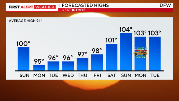
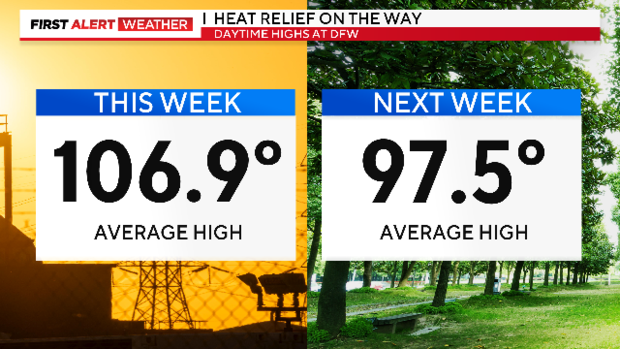
There is a significant weather pattern change this week ahead. After a brutal week of heat, there is a little bit of a cool down. We could go the entire work week under 100°. That hasn't happened since early July.
Rain chances on Sunday and Monday are decent at 20% to 30% but coverage still looks rather meager.
There could be a hurricane in the Gulf by Tuesday. Tropical Depression Ten isn't moving much on Sunday but likely will become Tropical Storm Idalia. Forecast models spin it up to a Category 1 hurricane before making landfall Wednesday morning somewhere in the Florida Big Bend or Panhandle.
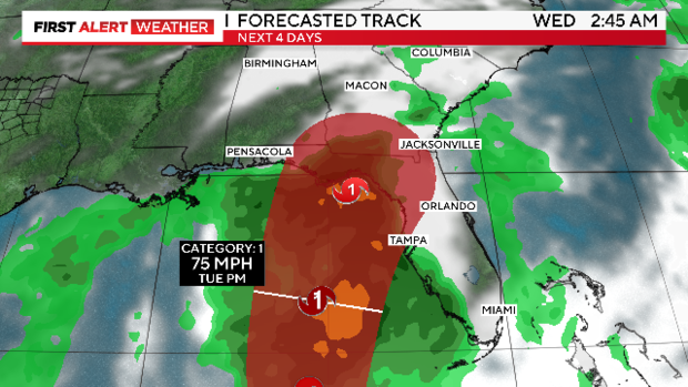

The system is headed the wrong way for us to get any rain from it. We get a couple of days of small rain chances, then right back to dry weather. We are forecasting the return of 100° days just in time for the Labor Day holiday.