Strong to severe storms expected Thursday afternoon & evening
I hope you enjoyed the warm and breezy Wednesday we got in North Texas. Now, we gear up for some active weather to end our spring break week.
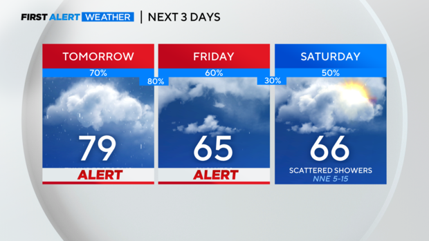
Weather Alerts have been issued for Thursday and Friday. Thursday is the most concerning day for severe weather across North Texas. Instability will be highest the farther north and east you go, and the Storm Prediction Center has shifted its Level 2 "slight" risk area farther east. It still includes most of the metroplex. And you'll notice that up towards Paris there is now a Level 3 "enhanced" risk area.
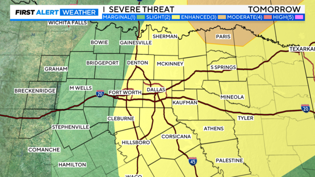
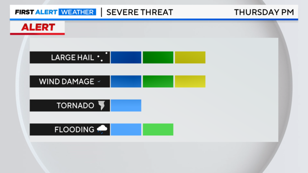
The most significant threats for our area will be large hail and damaging winds. As mentioned over the last few days, the tornado threat is low but not zero. It's likely that the storms with the best potential for tornadic activity will be the storms moving closer to Paris in the "enhanced" risk area. Our flooding threat increases Friday with another disturbance moving into North Texas behind the cold front.
Thursday morning should be fairly quiet with a stout cap in place. Remember, the cap is a layer of warm air higher up in the atmosphere. It prevents storms from developing.
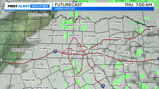
But as temperatures warm into the afternoon and a dryline approaches from the west, we are expecting the cap to break and storm activity to ramp up rapidly.
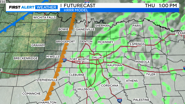
The most likely scenario is the cap will erode away by mid-afternoon (3-4 p.m. timeframe). If the cap isn't quite as strong Thursday morning, then we'll have to be prepared for storm development earlier in the afternoon (closer to midday). Most models are in agreement with storms developing after the 3-4 p.m. timeframe.
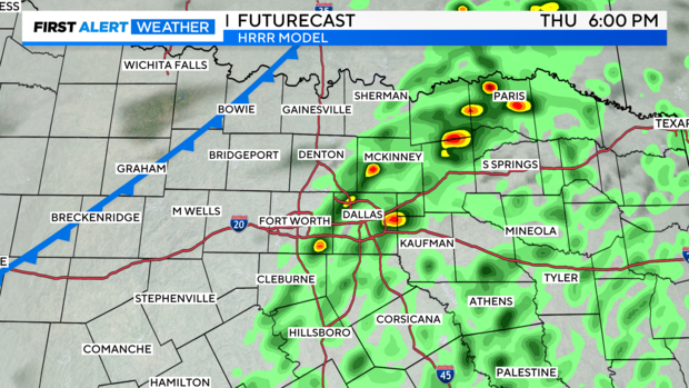
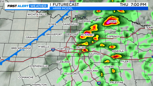
You can see how quickly these storms intensify in just one hour. Note that as the storms move into a more favorable environment, closer to Paris, they really intensify. This is where the greatest risk will be for large hail and tornadoes (at least in North Texas).
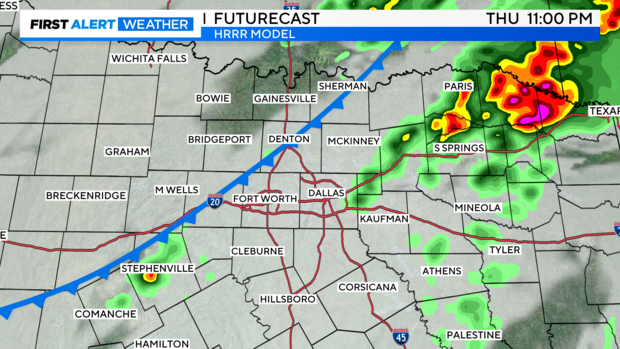
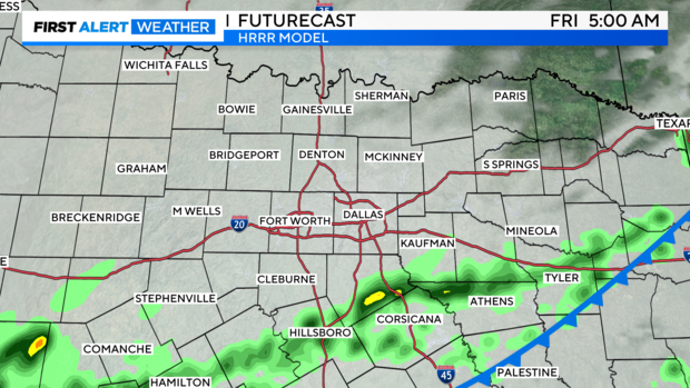
As the cold front finally moves through overnight Thursday into Friday, we'll still have to keep an eye on storm initiation along the frontal boundary.
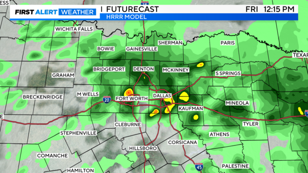
It may be on the quieter side early Friday morning with the front moving out of the area. But another disturbance will bring post-frontal rain and even some isolated storms to North Texas as soon as late morning Friday, and this activity will likely continue into the afternoon.
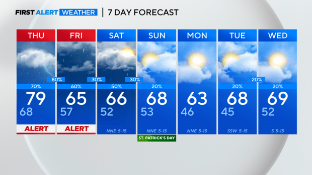
While the overall severe threat may be lower on Friday, the potential for heavy rain and minor flooding would increase in this scenario. This is why we're opting to keep our weather alert through Friday.
Saturday remains a cloudy and rainy day with scattered showers and general light rain around. By Sunday, it will remain on the cloudier side but the rain chances drop to 20%.
Have a good night!
-Erin