Strong-to-severe storms possible overnight into morning
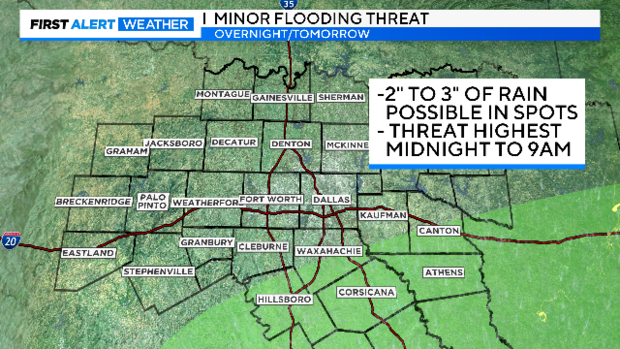
NORTH TEXAS - Strong storms are possible south of the metroplex Saturday night with a minor flooding threat, and some snow/rain/sleet mix in our northwest counties Sunday night.
The strongest storms will be overnight and Sunday morning.
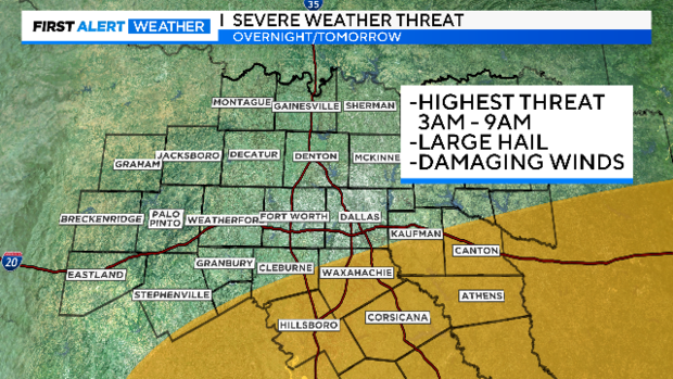
Heavy rain is also possible with these storms. Please drive with care late Saturday night and Sunday morning in the areas in green below.
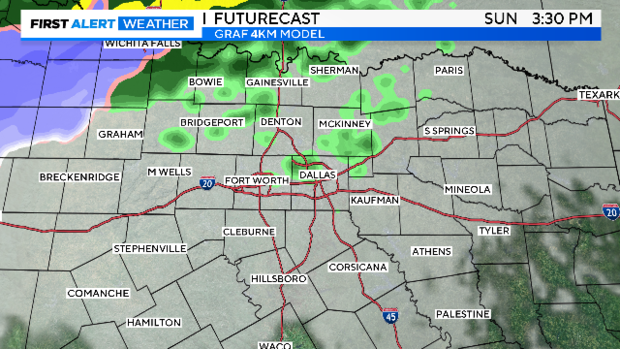
Below is a series of First Alert Futurecast maps. Overnight we are expecting a line of strong-to-severe storms crossing the I-35 corridor south of I-20.
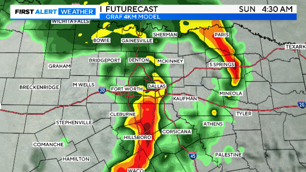
By mid-morning Sunday and across the afternoon, we are expecting modest coverage of passing showers under cloudy and breezy conditions. Temperatures will only be in the mid-50s.
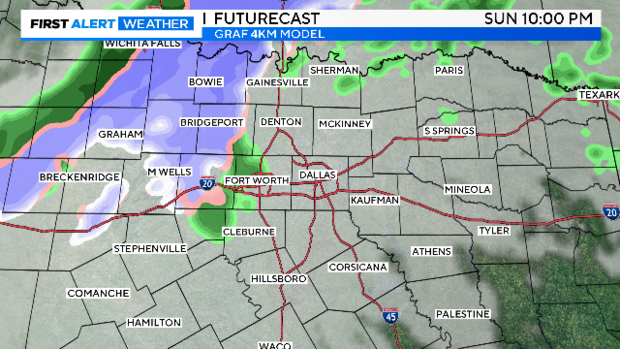
We'll close the day and get into the evening with some snow/sleet/rain mix going on across our northwest counties. This could accumulate on windshields and grassy surfaces but likely have zero impact on travel.
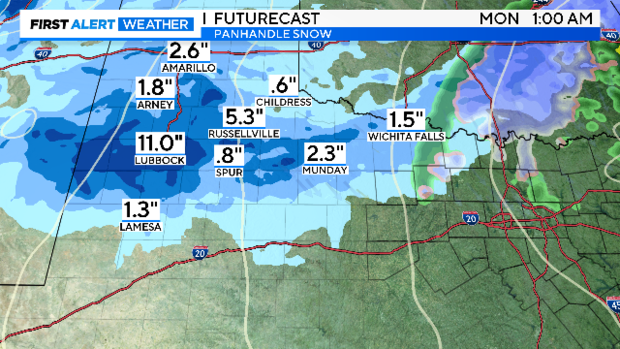
The big snow Sunday will be out in the Panhandle.
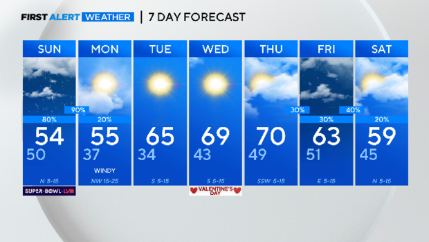
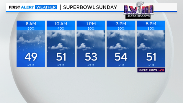
Here is your Super Bowl Sunday forecast. Coats are recommended for traveling to and from your Super Bowl Party.
Some of this cold rain will linger into the overnight hours heading into Monday. The day will likely start cloudy and windy but quickly give way to some sunshine. Most of the week ahead looks mild and dry. Next weekend is yet another chance of rain. No freezes in the forecast, the last one was almost three weeks ago.