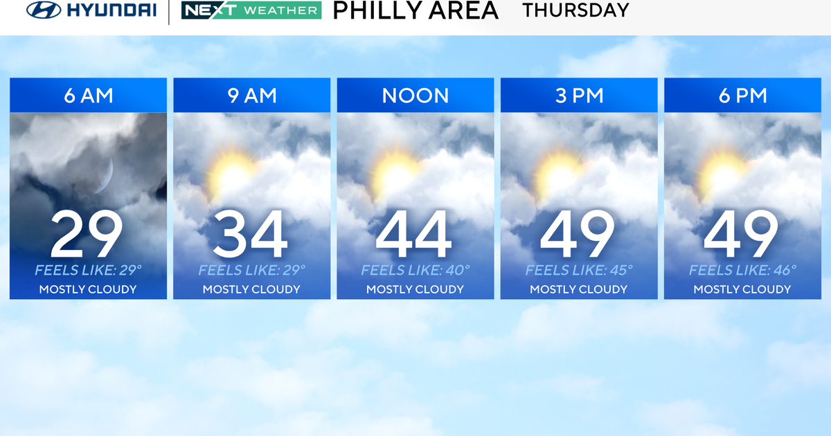
Stormy, Chilly Few Days Ahead In DFW Area
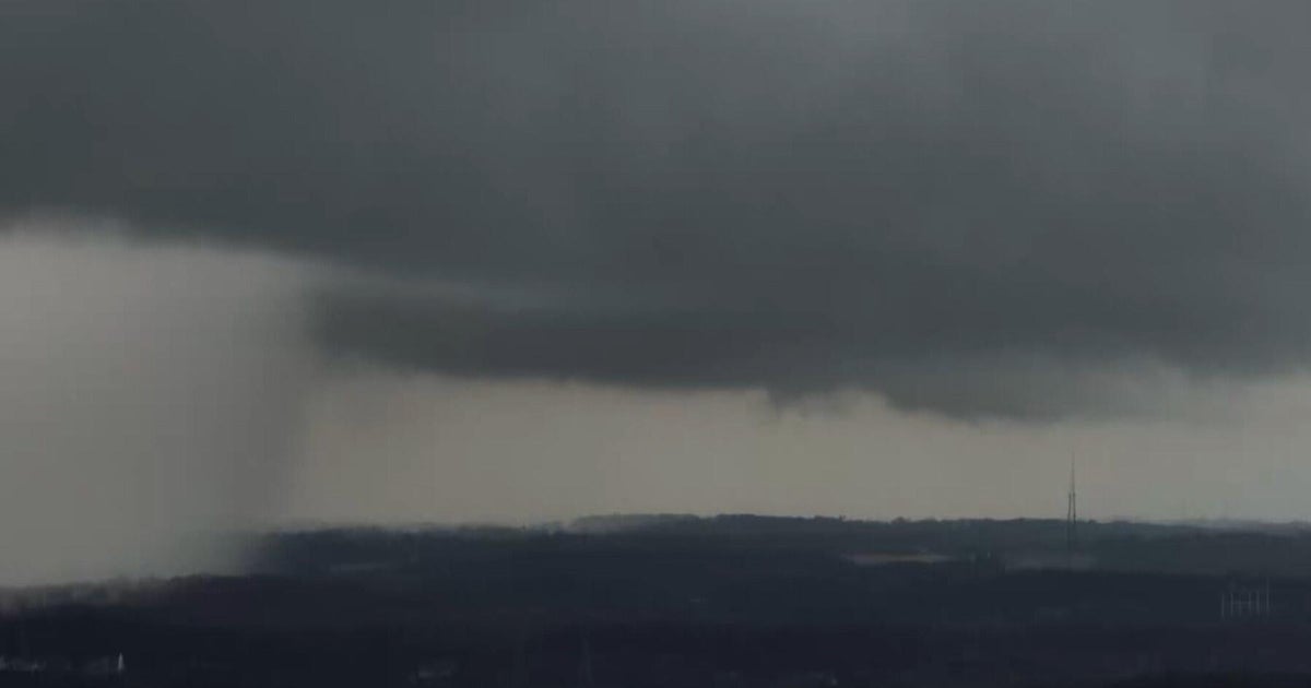
FORT WORTH (CBSDFW.COM) – Spotty showers will continue through Wednesday evening and overnight as strong south winds continue to transport Gulf moisture northward over our area.
A cold front is expected to arrive tomorrow afternoon. Strong storms and a few severe storms will be possible. Large hail will be the main threat.
The cold air will likely undercut these thunderstorms, which would limit the wind threat and dramatically decrease the threat of tornadoes.
Temperatures will turn cool quickly behind the front, falling into the 50s behind by late in the afternoon tomorrow. Showers will continue behind the front tomorrow night into Friday.
More showers are possible on Saturday. Rainfall totals by the end of the weekend could be well over two inches and some areas east of Dallas may see four inches of rain over the next several days.
It will be chilly on Friday and Saturday with temperatures staying the forties and fifties each day.