Storms in forecast through Thursday; severe potential tonight
NORTH TEXAS (CBSDFW.COM) - This first week of May is living up to its reputation. Storms are in the forecast every day through Thursday evening, and there's the chance for severe weather nearly every day.
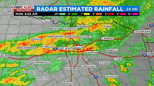
North Texas got by relatively unscathed overnight – receiving some decent rain, hail and strong winds but no reports of any major issues. Now the wait begins to see what transpires this afternoon and evening.
A dryline will approach from the west Monday afternoon and we'll watch to see if any storms can develop. If they do expect the storms to turn severe, with high winds and large hail being the main threats... but it's a big "if."
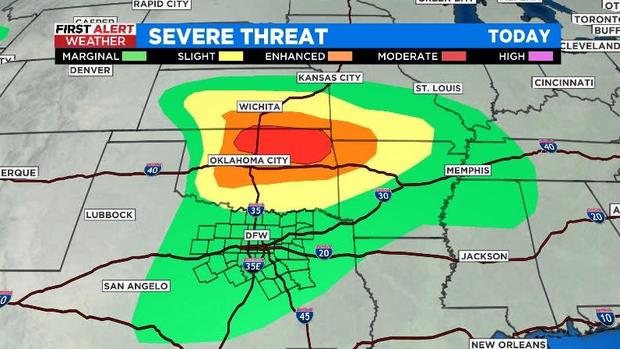
The Storm Prediction Center actually pushed the Level 2 "slight" risk for severe storms up into Oklahoma, leaving our region with just a Level 1 marginal risk. Note the Level 4 "moderate" risk in Oklahoma – it's going to be a rough afternoon/evening for our friends to the north.
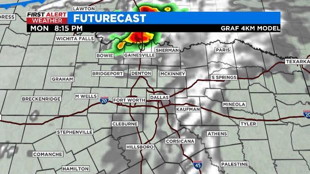
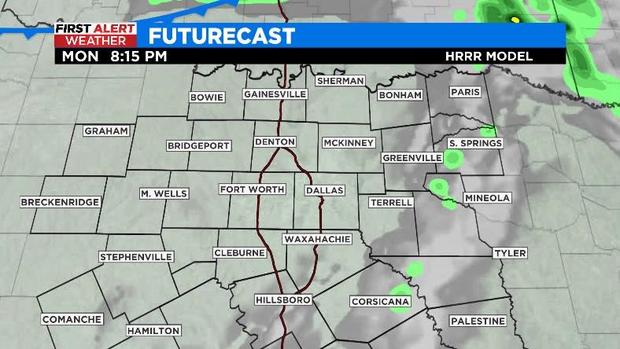
Back to our weather. The question is which model do you believe? GRAF has storms firing along the dryline and then riding along the TX/OK line – these would be severe. The High-Resolution Rapid Refresh (HRRR) model has nothing.
What's important about this distinction in the models is the cold front you see in the corner of the image. We are expecting storms to move in overnight from that front. But if we've been dealing with severe storms already along the state line, the atmosphere may be a little more stable and the strength of the storms won't be as intense.
If nothing happens from the dryline, the atmosphere will likely have a little more 'juice' for this line of storms to work with overnight. This is reflected in the models, as well.
I'm leaning more towards the HRRR model, which would mean not seeing storms this afternoon/early evening but seeing storms in the overnight hours as the cold front swings through. While the storms overnight would be strong, I think they'll be weakening as they continue moving south.
This week's forecast is going to be a day-by-day thing. It's the time of year where thunderstorms from the previous day will affect the position of fronts and the amount of instability available for new storm development. A lot of the time, it isn't something that can be predicted more than a day or two out.
