Storm chances return Monday, increase Tuesday in North Texas
NORTH TEXAS – Saturday proved to be warm, breezy and dry across North Texas.
It was the warmest day so far in June after hitting 98° back in May and was close to tying a record. That feel-like temperature we watch most of the summer topped out just over 100° at DFW.
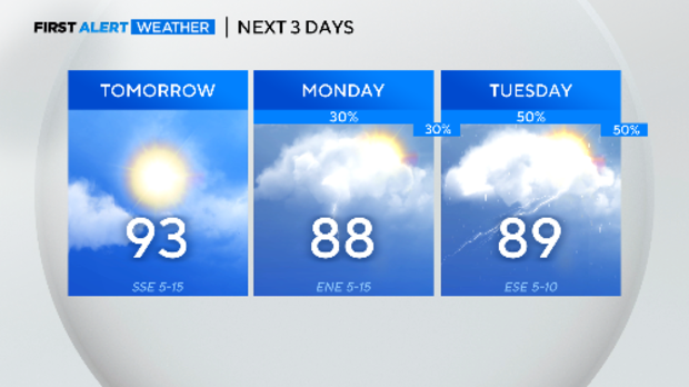
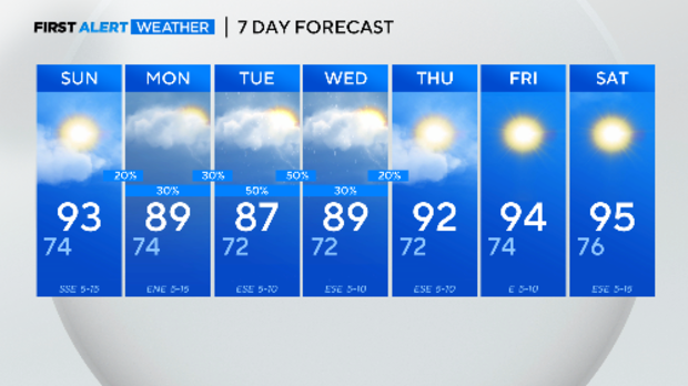
Sunday promises to be another pool day: hot and dry. It'll be a few degrees cooler thanks to more clouds, but it'll be more humid with less wind. The feel-like temperature will again top out in the low triple-digits like Saturday.
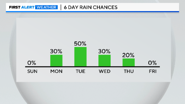
Since March 1, the longest dry streak at DFW has been six days. We won't go that long before the next rain chance shows up here in North Texas.
With the storm chances returning on Monday, at least there it'll drop the daily highs.
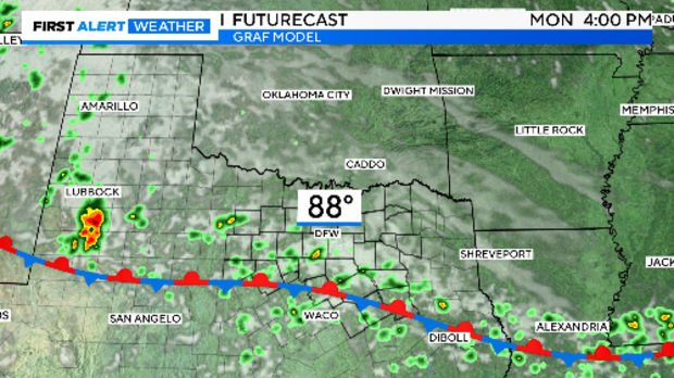
A weak front should move into North Texas early Monday and stalls out by afternoon somewhere over our area. The best storm chances should be close to the front, but everyone should have a least a 30% chance. Small hail and gusty winds are possible with the storms that develop.
The storm chances on Tuesday look better. While the severe weather threat looks low, there will be a flood threat with any storm that lingers over any of our counties. We'll have more on Sunday as the forecast models (hopefully) come into more agreement.
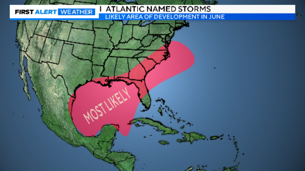
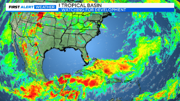
Meanwhile, this is the month where we keep an eye to the Gulf of Mexico for tropical storm development. Named storms are rare in June. While there are plenty of storms over those warm ocean waters today, there is almost NOTHING going on in the favored development area.
As soon as those storm chances start to wane around here, we jump right back to the 90-degree days. No triple-digit days in the forecast just yet. On average (since 1980), the first one arrives in early July at DFW.
