First Alert Weather: Storms could affect your commute home Thursday evening
NORTH TEXAS (CBSNewsTexas.com) — A cold front is currently sweeping over North Texas bringing storms and cooler temperatures.
While we're not expecting an outbreak of severe weather, a few storms could develop and produce gusty winds, small hail and periods of heavy rain. Some localized flooding is also possible.
The threat of tornadoes is low, and we can expect to see storms developing anytime between 2 and 8 p.m.
Areas along and east of I-35E will have the best chance of seeing strong storms today. Showers and storms will push farther to the south of I-20 tonight.
Outside of these weather concerns, North Texas will see some cloudy skies today with highs in the mid-to-upper 60s. By nightfall, lows will be in the upper 40s.
On Friday, while a stray shower is possible, most areas will be dry under partly cloudy skies. Highs will be in the mid-60s.
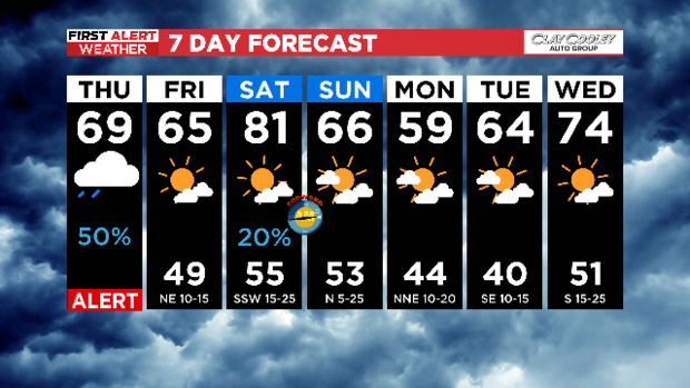
Our temperature roller coaster ride will continue into the weekend. In fact, highs will be in the low 80s Saturday, then they'll fall into the mid-60s on Sunday after a cold front passes by.
A few isolated showers and storms are possible Saturday, mainly north toward the Red River, and we'll watch that threat closely.
To stay weather-aware today and every day, make sure to check out our weather page, and our 24/7 streaming service.