Spring Storms Make A Quick Return To North Texas, Chance For Severe Weather Tonight
NORTH TEXAS (CBSDFW.COM) — The first weekend of spring saw near-perfect weather conditions with plenty of sunshine and mild afternoons, but with that change in seasons comes the threat for storms and severe weather.
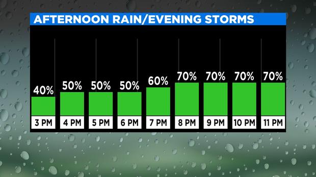
On this Monday, we start off with a big change as clouds have raced in overnight. Scattered, lighter showers are around morning-early afternoon, especially for locations west of Interstate-35. The later half of the day takes our focus as a dry line across West Texas works this way, followed closely by a cold front. These features will help to ignite a complex of strong to severe storms starting during the evening period and wrapping up shortly after midnight.
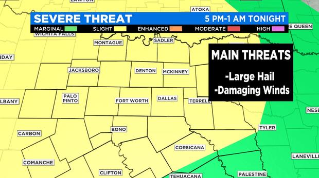
The main threats with any storms that develop will be large hail (quarter-sized or greater) and damaging wind gusts of up to 60 mph. The threat for tornadoes appears low at this time and will help be determined by how much, if any, sun we can get this afternoon. Localized flooding will be possible as these storms will be efficient rain-producers that could drop off more than an inch of rain in any location.
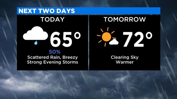
Based on the latest forecast, storm impacts for the Metroplex look to fall in a 7 p.m. to 10 p.m. window as storms quickly race from west to east. By daybreak Tuesday, storms should be long gone as a sunny and warmer day sets up.