Spring-like temperatures stick around a little longer
NORTH TEXAS – We're tracking more spring-like weather before storms moves in for part of your weekend.
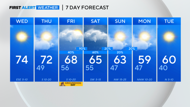
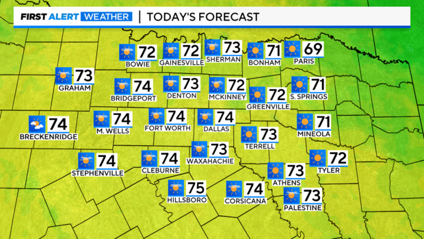
As we move through your Wednesday, it will continue to feel like spring with high temperatures in the low to mid 70s. We'll see mostly sunny skies to partly cloudy skies.
Tonight, we'll see partly to mostly cloudy skies and lows in the upper 40s.
On Thursday, we'll see partly cloudy skies. High temperatures will be in the low 70s.
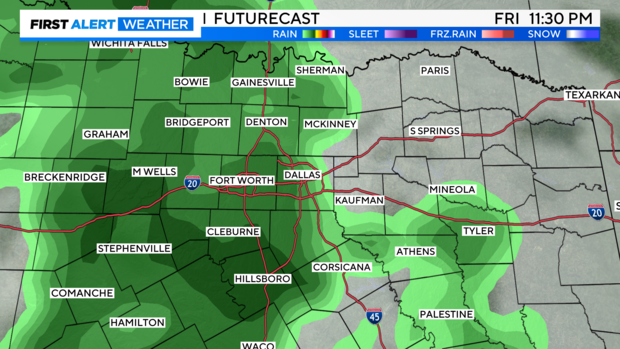
Heads up! Rain and storms return with a cold front from Friday (Groundhog Day) into Saturday.
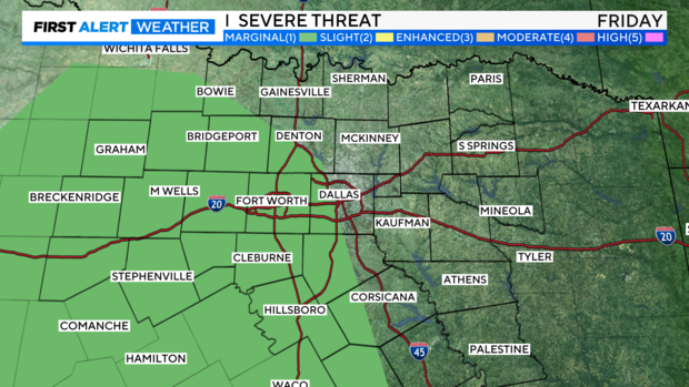
The cold front will cross the country from the west coast and will arrive in North Texas by Friday, giving way to scattered rain and a few storms. Some storms could be strong with hail and heavy rain by Friday evening and night.
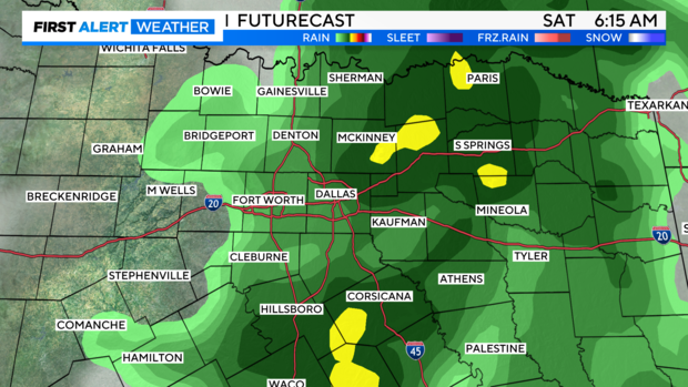
Showers and isolated storms will continue into Saturday as the front crosses North Texas.
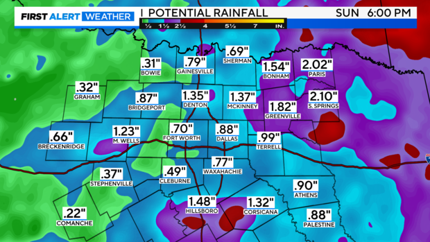
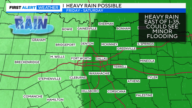
Some of the heaviest rain may impact areas along and east of I-35 Friday into Saturday. Between 1 and 2 inches or rain are possible with some isolated higher amounts. Minor flooding is possible. Remember turn around, don't drown!
High temperatures will be in the mid to upper 60s Friday and Saturday.
A lingering shower or two is possible as an area of low pressure rotates near our area on Sunday. Highs will be in the lower 60s.