Showers and thunderstorms expected through Labor Day in North Texas
NORTH TEXAS – Today, the Metroplex didn't see much convective activity. A few showers and storms emerged but were short-lived, and most of us missed out.
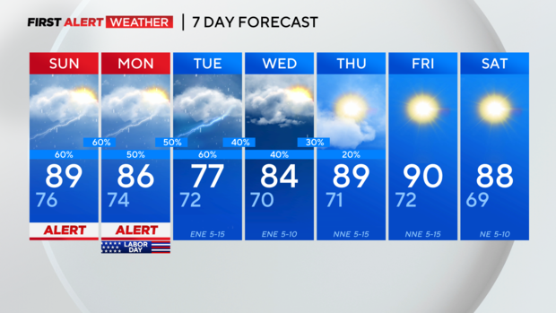
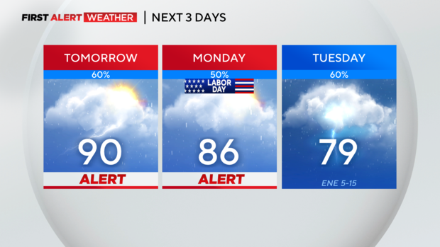
Expect scattered thunderstorms in North Texas on Sunday and Labor Day, mainly from midday through the evening. Morning showers and storms are possible but less likely.
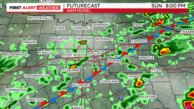
Starting with the high-resolution NAM 3km model, isolated activity will begin Sunday, likely near midday, and become more widespread across the DMA through the evening. A few heavier cells are possible, with gusty winds, lightning, and brief heavy rain.
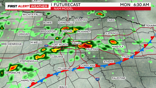
This model tries to continue convective activity through the early morning hours on Labor Day, but this seems less likely due to our environment and a less suitable thermodynamic profile. However, we'll keep an eye out in case this unfolds.
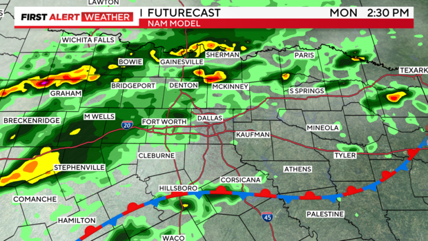
Scattered thunderstorms appear to be more widespread yet again, on Labor Day. This certainly seems plausible in the afternoon-evening hours.
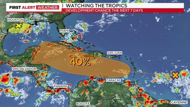
TROPICS: The disturbance in the Gulf has a 20% chance of formation. However, if this broad low-pressure area lingers over the warm Gulf of Mexico waters, it could slowly organize within a week. Regardless, it will likely affect our region by increasing atmospheric moisture content in much of Texas, known as Precipitable Water. We'll keep a close eye on this.
FARTHER OUT: In the Atlantic development region, a tropical wave has a medium chance of formation. This surface trough may organize as it moves past the Lesser Antilles and into the eastern Caribbean this upcoming week. Conditions should be generally favorable as this wave moves west, but it has some obstacles to overcome. Once it leaves the main atmospheric flow (monsoonal southwesterly flow), it will enter a region with more localized winds in the Caribbean. If it remains strong enough as it moves through the Caribbean, it could emerge in the southern Gulf, where waters are dangerously warm. We'll definitely need to keep an eye on this one.
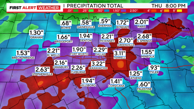
The rainfall trend is improving. The European model shows greater rain opportunities in the next 5-7 days, bringing much-needed rain to the region. Some areas were recently added to the severe drought monitor. Isolated higher amounts are always possible.
7-day forecast: