Severe weather returns to North Texas following a pleasant Monday

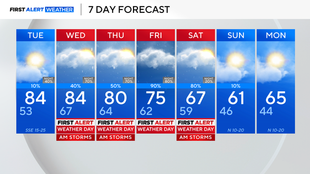
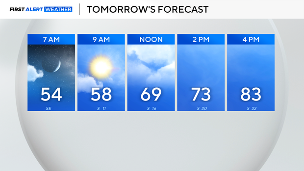
Following a nice and seasonable Monday in North Texas, our wind flow returns out of the south by Tuesday, warming temps back into the low to middle 80s, with a noticeable increase in humidity. We'll also be breezy to gusty by Tuesday afternoon, and clouds will gradually build throughout the day.
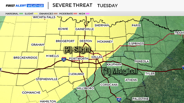
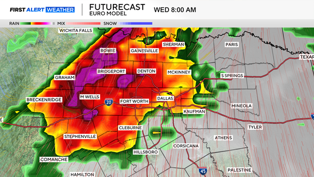
Most of Tuesday looks to remain dry, but shower chances start to build late, and overnight into Wednesday. From Wednesday morning through Saturday morning, we'll be looking at periodic rain and storm chances, with a severe threat almost every day. For that reason, the First Alert Weather team has issued First Alert Weather Days Wednesday through Saturday.

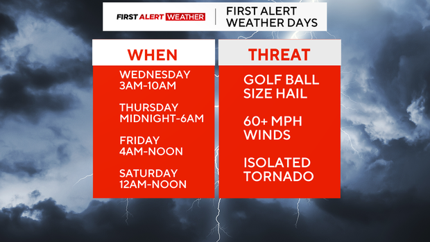
As far as timing, expect scattered storms Wednesday morning, clearing to the east-southeast into the early afternoon. We'll then see a lull in activity during the afternoon hours.
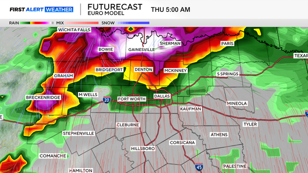
Our next round arrives overnight and into Thursday morning. This will be similar timing to Wednesday, clearing to the east-southeast into the afternoon. Both days carry a large hail and damaging wind threat. The tornado threat is low, but not zero.
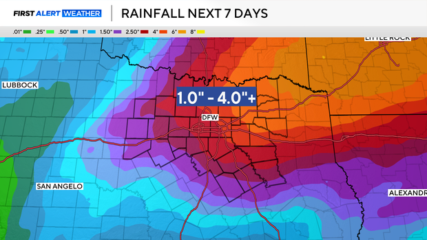
Our next round arrives overnight and throughout Friday. Friday will be a more widespread rain day, with hefty totals expected. This continues into the start of the weekend, with heavy rains and storms Saturday morning, eventually clearing up into Saturday afternoon.
A cold front knocks temps into the 60s for the weekend. Sunday looks dry, just much cooler.