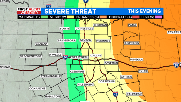
Severe storms possible for East Texas counties through the evening
NORTH TEXAS (CBSDFW.COM) – A strong cap in place this morning has kept any storms from becoming severe in North Texas so far.
The cap has been weakening through the afternoon hours and storms are developing in our eastern counties.
There is still the potential for a few of them to become severe with damaging winds, hail, or even a tornado.
One of our forecast models continues to develop a few strong to severe storms through the evening hours in our eastern counties.
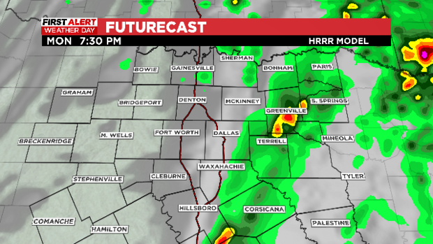
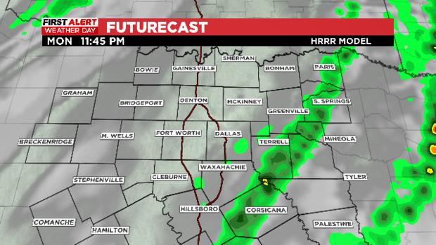
Another line of showers and a few storms are possible around 9 p.m. to 11pm as the cold front swings through the area.
This activity, once again, will be focused east of I-35.
Most of the severe storms have been focused in East Texas, Louisiana and Arkansas where we were expecting them.
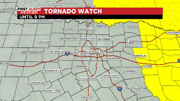
A tornado watch is in effect for these areas until 9 p.m. tonight, it does not include North Texas.
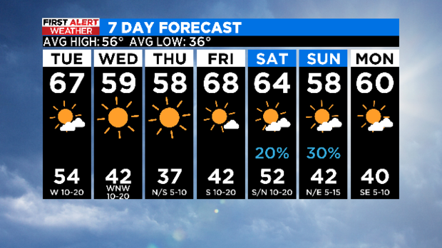
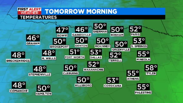
Cooler air moves in overnight behind the cold front, allowing temperatures to drop into the lower 50s by Tuesday morning.
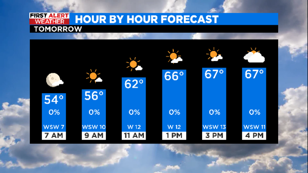
We enjoy a mix of sun and clouds tomorrow with highs in the upper 60s.
Another cold front brings a reinforcing shot of cooler air for mid-week, returning temperatures closer to seasonal averages with sunny skies.
Looking ahead to the weekend, showers return to the area late Saturday into Sunday morning.