Severe Storms Possible In North Texas Tuesday Night, Wednesday Morning
NORTH TEXAS (CBSDFW.COM) -- After a sunny start to the work week, clouds are rolling back in ahead of our next storm. That storm is impacting the Four Corners as of Tuesday morning but will quickly race east and move into the Texas Panhandle by this evening.
As a warm front lifts north of NTX today, a surge in moisture unfolds with humidity creeping up and clouds remaining thick.
A brief, light shower can't be ruled out as this warm air mass moves in, but most of the region is dry through the day Tuesday.
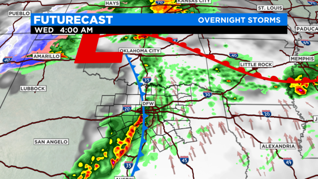
The main focus is on activity expected in the overnight hours Tuesday night, from midnight through around sunrise on Wednesday.
A line of strong to possibly severe storms will travel in from west to east, passing through the Metroplex in the pre-dawn hours.
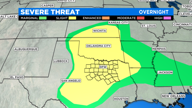
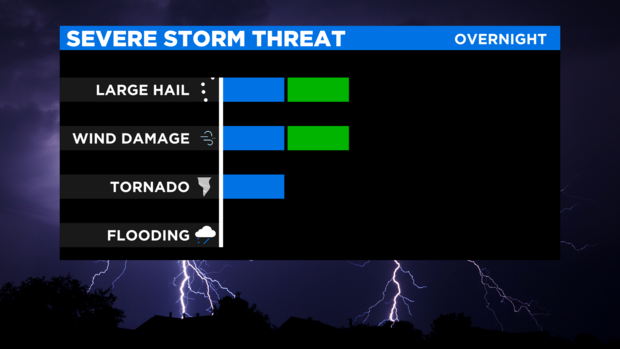
As of now, there appears to be a threat for damaging winds up to 60 mph and hail of up to quarter-size.
Not all of North Texas will see rain overnight; the best chance appears to be just west of I-35 and through East Texas.

This quick shot of rain is over by mid-morning Wednesday, providing a mostly dry St. Patrick's Day.
While sunshine is around for Wednesday, gusty north winds will make outdoor festivities challenging as gusts could approach 40 mph.


