Severe Storms, With Large Hail, Damaging Winds, Possible For Metroplex This Afternoon/Evening
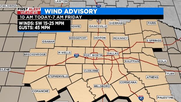
NORTH TEXAS (CBSDFW.COM) - A Wind Advisory is in effect for all of North Texas until 7:00 a.m. Friday. And an incoming incoming weather system brings the possibility of wind gusts up to 45+ mph.
As it stands, severe storms are possible for the Metroplex and points north/east this evening. Those storms could include large hail and damaging winds.
As the cold front approaches from the northwest, winds will start to get stronger this afternoon/evening and remain gusty into the overnight hours.
A dryline moves into the western counties this afternoon, bringing a big drop in humidity for some. This coupled with very dry vegetation and warm/windy conditions will create a critical fire threat for locations west of Highway 281.
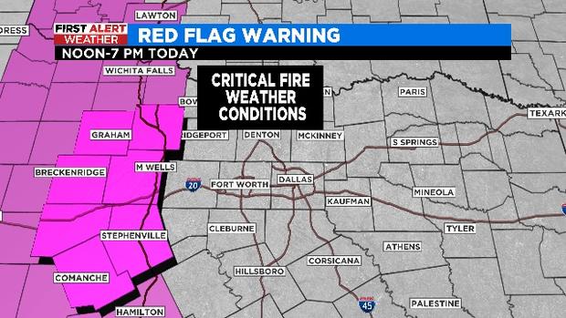
A Red Flag Warning -- when warm temperatures, very low humidity, and strong winds increase the fire risk -- is in effect from noon until 7:00 p.m. for our western counties.
As it stands, the threat for large hail is the main focus (quarter-size to golf ball-size).
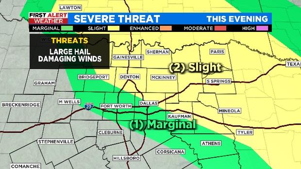
In counties to the far east, the threat of damaging winds, between 60-75 mph, is possible.
Isolated storms will likely initiate sometime during the late afternoon and early evening near or just west of Interstate-35 in counties to the north. Scattered coverage is expected for locations east of I-35 by late evening.


