Scattered storm chances in North Texas through Wednesday before drying out
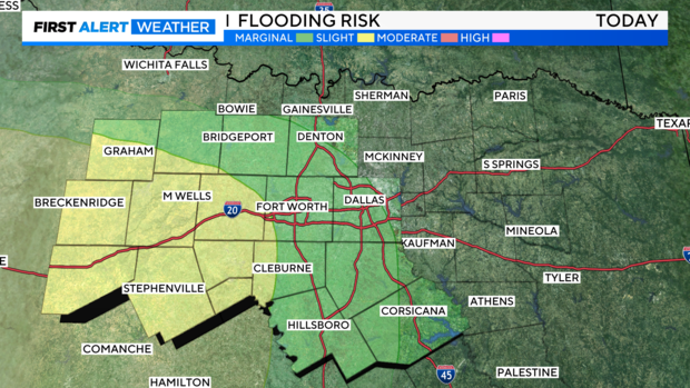
NORTH TEXAS – The Weather Prediction Center (WPC) places us in a marginal to slight risk of flooding, increasing from east to west across the region. Scattered storm chances should continue on and off through Tuesday before significantly decreasing.
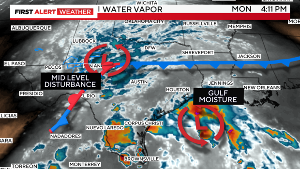
A cooler-pool disturbance at mid-levels that emerged from northern Mexico is stationed just west of Dallas-Fort Worth, flanked by a weak frontal boundary that has pushed through the metroplex to the south. Excess moisture from the Gulf low is also streaming into parts of the state, increasing rainfall rates and making localized flooding more likely in areas experiencing the heaviest activity.
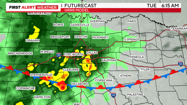
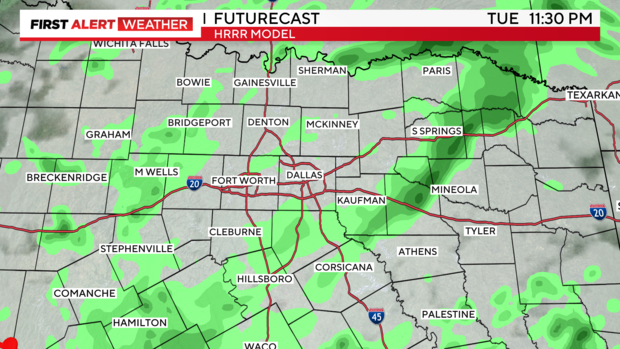
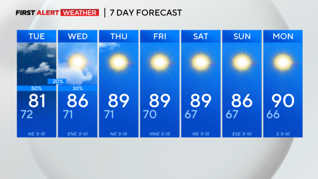
So far for Labor Day, things have been somewhat quiet across the DMA, but that could change in the next 12 hours. The consensus appears to be that showers and isolated thunderstorms will overspread our central counties as we near dawn on Tuesday. As folks return to work and kids to school, we could have heavy downpours in the region along with some thunderstorms. Localized heavy rain can't be ruled out if cells have enough energy to work with.
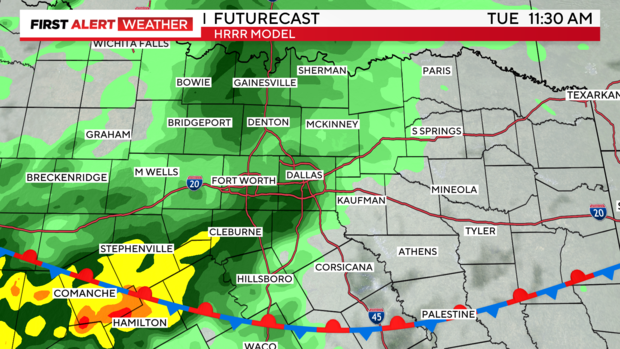
Activity should gradually wind down throughout the day on Tuesday.
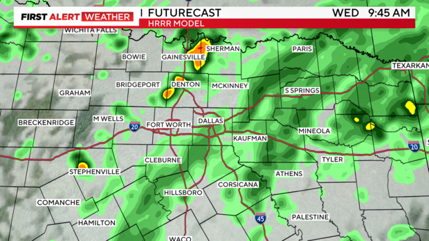
More sporadic pop-up storms are possible again on Wednesday, with the best chance occurring primarily in the afternoon near the diurnal maximum when heating is adequate.
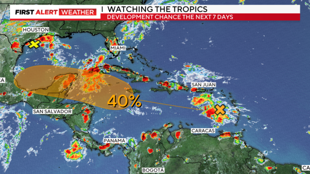
TROPICS: The disturbance along the Texas Gulf Coast has dropped off the National Hurricane Center's (NHC) tropical development chances. However, there remains one area to watch into the weekend. The tropical wave over the Lesser Antilles is very disorganized and has a 40% chance of formation over the next seven days. The European ensemble, one of the most reliable models, indicates a good chance of a tropical depression forming in the southern Gulf by the middle of next week. This warrants attention due to the extremely warm Gulf waters. If any tropical system lingers over these waters, rapid intensification is likely.
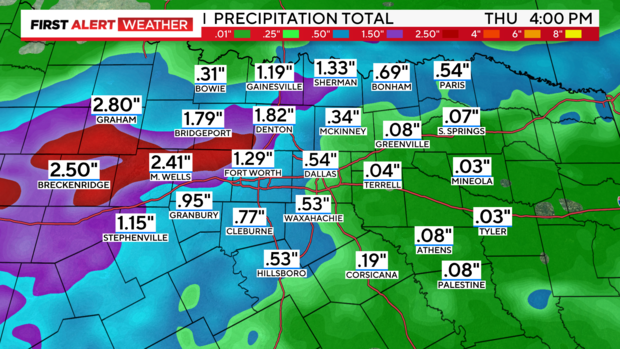
The overall rain trend through Thursday has decreased, but still favors our western counties.
7-Day forecast. I can't complain!
