Scattered showers, cooler air ahead for North Texas

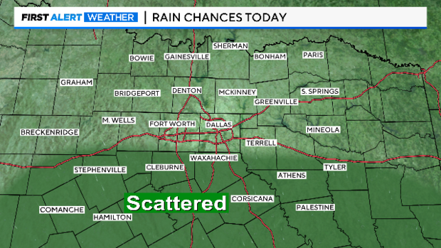
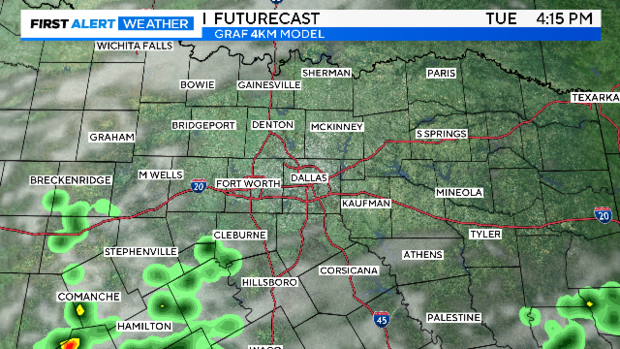
NORTH TEXAS – Tuesday started off with scattered showers and storms south of I-20.
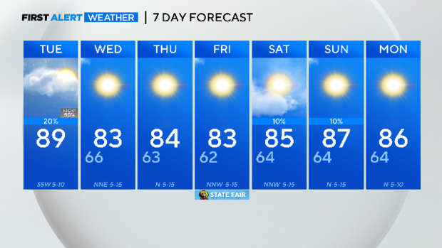
Low rain chances stick around through the day on Tuesday. However, there will be more sunshine and a warmer day with a high in the upper 80s and feeling like the low 90s.
A weak cold front will move through North Texas overnight and will bring a 50% chance of showers and storms in the overnight hours. The front will bring cooler air with highs in the low 80s on Wednesday and Thursday.
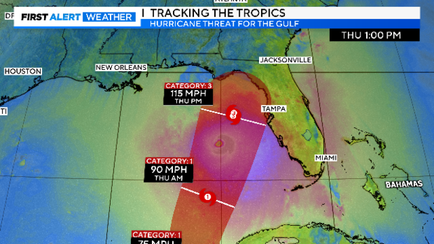
State Fair of Texas opening day is looking better but there will be a mix of sun and clouds with highs in the lower 80s. All eyes are on the tropics as potential tropical cyclone nine continues to strengthen.
The potential storm will develop into Helene later on Tuesday then looks to increase to a major hurricane by Thursday evening. If it takes the perfect center track, then it will make landfall in the Big Bend area of Florida early Friday morning.
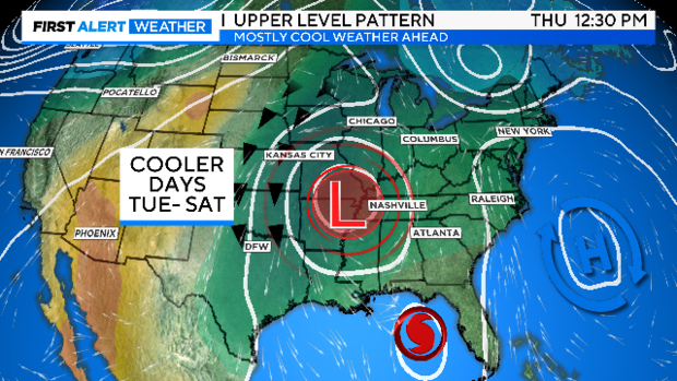
As Helene moves inland at the end of the week, an upper-level trough will develop in the upper Midwest.
An upper-level low will move into Missouri and Illinois and Helene will get absorbed into the upper low. The center will be northeast of North Texas, keeping us in a northerly flow and temperatures cooler than average.
However, as of Tuesday, it looks like a great weekend in store with plenty of sunshine and nice temperatures for the start of the State Fair of Texas.