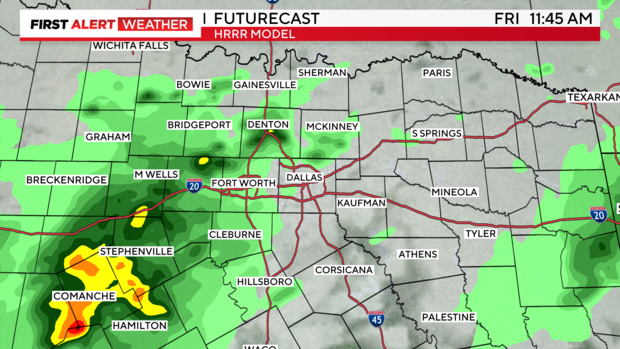
Scattered showers continue across North Texas
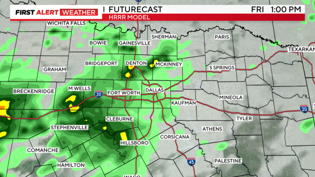
NORTH TEXAS - We still have a Weather Alert in place for this morning. The threat for severe weather is low for the rest of the day. However, we've been keeping an eye on showers and isolated storms to our southwest, moving toward NTX. We'll watch these closely, but we may see a few of these storms impact our area - possibly even the Metroplex this morning into the early afternoon.
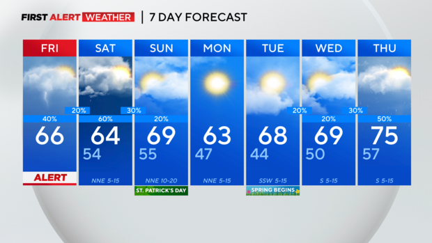
With that said, we may keep the Weather Alert up through at least midday, but stay tuned. Again, a few isolated storms are possible this afternoon. Otherwise, this afternoon, we'll see mostly cloudy skies with a stray shower or two. Afternoon temperatures will be in the 60s. Tonight, we'll see mostly cloudy skies and lows in the mid 50s.
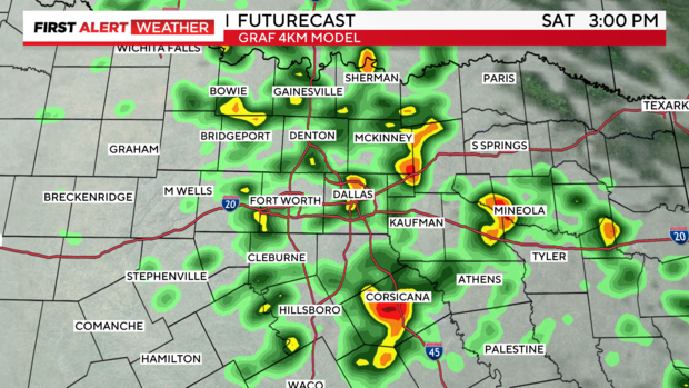
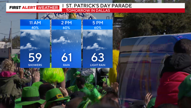
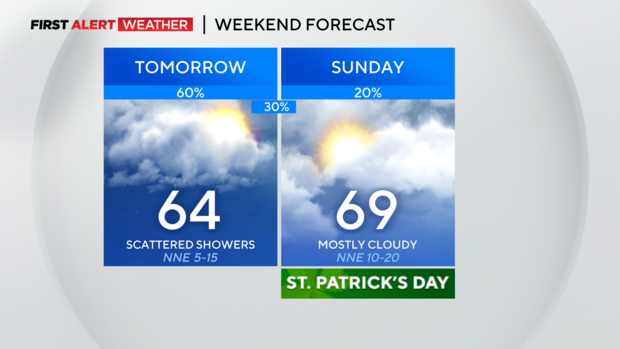
We're tracking more scattered showers on Saturday, which is not great news for the St. Patrick's Day Parade and festivities in Lower Greenville in Dallas. An isolated storm or two could develop on Saturday, too. The threat for severe weather remains low. Otherwise, expect mostly cloudy skies and highs in the low to mid 60s.
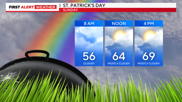
On St. Patrick's Day this Sunday, expect mostly cloudy skies. An isolated shower is possible. The rain chance is around 10-20%. Highs will be in the upper 60s.
Mostly sunny skies are in Monday's forecast. Highs will be in the lower 60s.
Highs will be in the upper 60s for the first day of spring, which is Tuesday.