Saharan dust keeps temperatures just below 100 degrees in North Texas
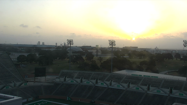
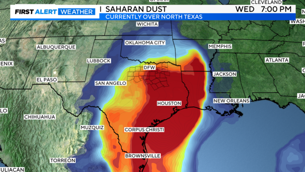
NORTH TEXAS – Saharan dust moved into North Texas Wednesday morning and will linger through sunset.
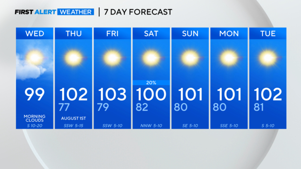
The dust layer, gusty winds and humid air will keep high temperatures from reaching the triple digits on Wednesday but it will get very close. The high on Wednesday could reach up to 100 degrees in some parts of Dallas-Fort Worth.
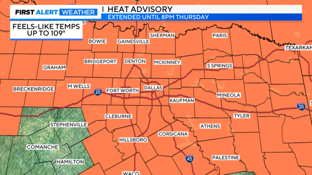
The humidity is in play and the "feels-like" temperatures are in the dangerous category again today with the "feels-like" temps up to 109°. The heat advisory continues until 8 p.m. Thursday for most of North Texas so make sure to take the time to hydrate, take breaks in the shade or even in the air conditioning if possible.
The dewpoint temperatures show the mixing of the drier air Wednesday afternoon and into Thursday afternoon as they drop to the 60s and even 50s in some spots.
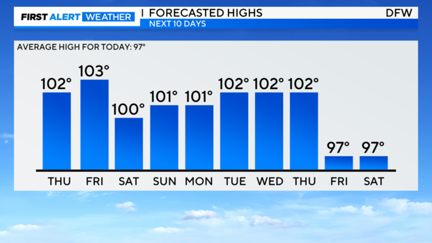
This means that high temperatures get hotter the next few days as the ridge axis of high pressure shifts west these next few days. While the "feels-like" temperature won't be as much of a factor for the forecast, the actual high temperature looks to be in the triple digits as soon as Thursday and remain there through the weekend and into next week.
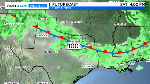
There is a small glimmer of hope in the extended forecast as a weak cold front slides into North Texas on Saturday. Don't expect a washout as the chance of rain is 20% on Saturday. There could be some isolated storms develop and the biggest threat could be some downburst winds with these storms.
Don't expect a big cool down behind the front as temperatures look to stay in the triple digits.

