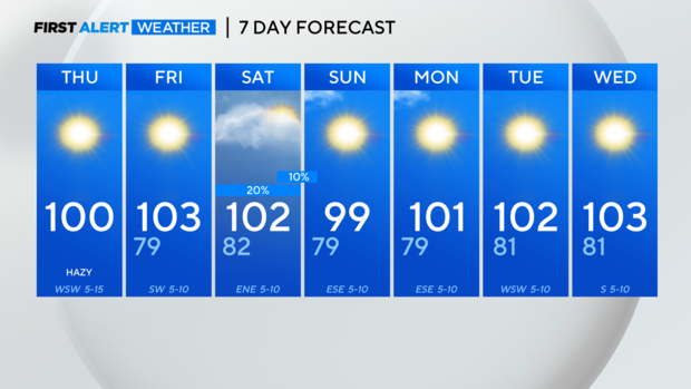
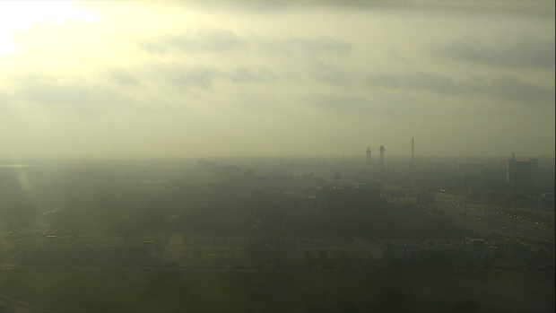
Saharan dust continues to linger over Dallas-Fort Worth, creating hazy skies

NORTH TEXAS – A hazy, hot day is in store for North Texans as the weekend approaches.
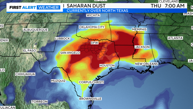
The haziness is due to the Saharan dust still lingering over the Dallas-Fort Worth Metroplex.
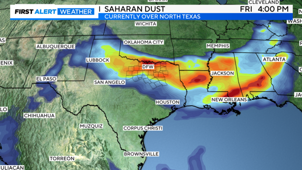
The Saharan dust layer should thin out later on Thursday and as the mid to upper-level winds turn more northwest to north, the dust should be pushed out of the area.
On top of the hazy sky Thursday, the high temperatures warm to the triple digits thanks to drier air in the mid-levels of the atmosphere then will mix down to the surface later in the day. The humidity won't be as bad thanks to the drier air but the trade-off is the actual high temperatures will be warmer and August starts off with triple-digit high temperatures.
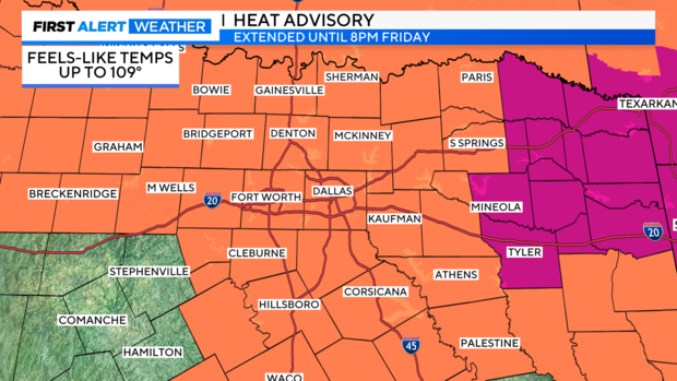
The daytime mixing of the drier air drops the dew point Thursday afternoon to the mid-50s according to the Graf forecast model. This means that the "feels-like" temperature won't be much higher than the actual high-temperature forecast of 100 degrees. This is borderline criteria for a heat advisory but the National Weather Service has extended the heat advisory to Friday evening for most of North Texas.
Expect the heat advisory to be extended into Friday because the actual high temperature will be around 102 degrees to 103 degrees. Remember that a heat advisory is issued if the temperature is 103 degrees or the "feels-like" temperature is 105 degrees or higher for two consecutive days.
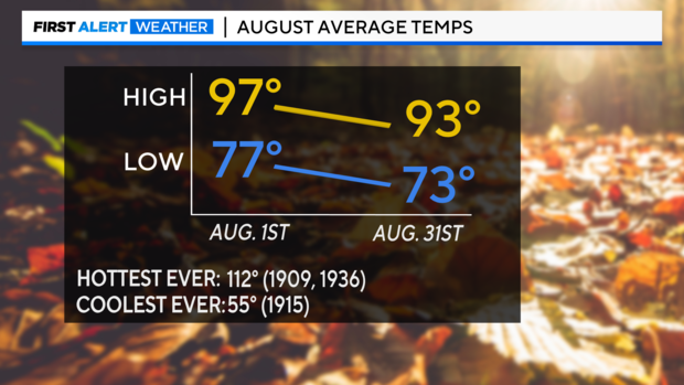
Right on cue, the August heat arrived on Thursday into Friday with the possible hottest day of the year in the forecast. It isn't out of the realm of possibility that it gets that hot in August. The month starts out with an average high temperature of 97 degrees and cool to an average high temperature of 93 degrees by August 31.
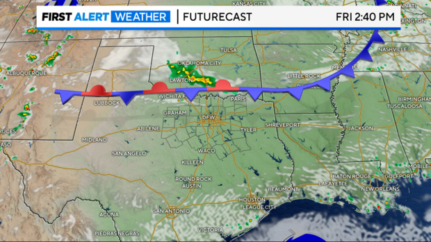
The heat is on for the next seven days. The ridge axis to the west Friday into Saturday keeps North Texas hot but also allows a northerly flow aloft to develop. On this northerly flow, a weak front moves into North Texas Friday night into Saturday. There is a small chance of some showers and a few storms with the frontal passage but the majority of Dallas-Fort Worth will remain dry.
The "cooler" air won't arrive until Sunday and the high temperatures drop just a few degrees from the high of 102 degrees to 103 degrees from Friday to Saturday. Sunday's high temperature will dip below the triple-digit mark but that doesn't last long. High temperatures climb back to the triple digits as soon as Monday and the upper-level pattern sweeps the moisture out of North Texas, making it hot and dry.