Rain brings slight relief to North Texas as heat advisory continues
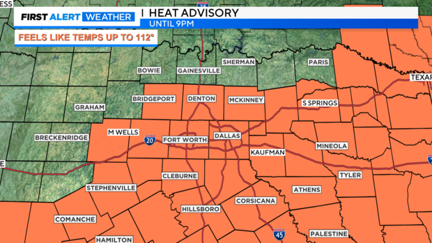
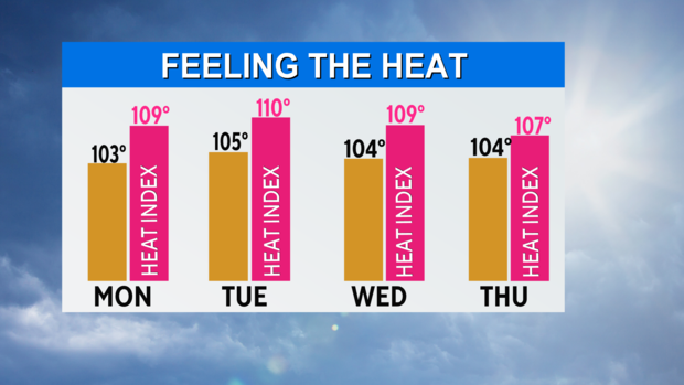
NORTH TEXAS (CBSNewsTexas.com) - There's another hot day ahead Saturday, with a heat advisory in effect until 9:00 p.m. Temperatures will climb into the triple digits, with it feeling close to 112 degrees at times.
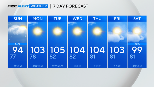
Clouds move in Saturday afternoon to take us below Heat Advisory levels. Storms will be around Saturday early evening and return early Sunday morning.
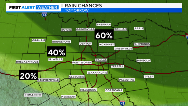
A weak front stalled over North Texas should inspire some storms in the early evening. Coverage is slight but some of the storms (in the dark green area) could be strong with gusty winds.
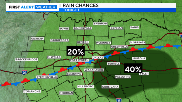
Overnight the northwest flow aloft should bring down another complex of storms out of the Panhandle of Texas.
The remnants of the frontal boundary will increase the rain coverage. We are not expecting severe weather but some gusty winds, heavy rain possible with these early morning storms. They should linger across the morning before the skies clear by late afternoon.

Showers and storms will be ongoing at sunrise Sunday morning and will taper off around midday.
Widespread severe weather is not expected but an isolated strong storm is possible with gusty winds, small hail and heavy rainfall.
Rainfall totals remain around 1/2" or less for most of the region, but a few areas could pick up a quick 1-2" where stronger storms develop. It won't be an all-day rain event with sunny skies in the afternoon. The front will provide a touch of relief from the triple digit temperatures, with highs in the mid 90s Sunday.
High pressure builds back over the area for next week returning the scorching heat, sunny skies and temperatures in the 100s, effectively ending any rain chances.
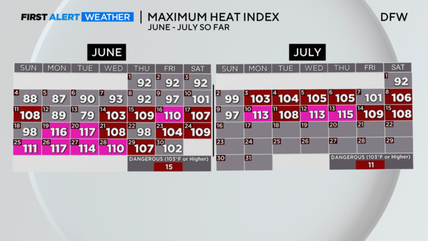
The full-on summer heat arrived as we got into the last weeks of June. Save for a few days, it has been over North Texas since. Today makes for the 26th day this year DFW has registered a high index of at least 103°F, the threshold the National Weather Service describes as "dangerous". We hit the halfway point of meteorological summer on Monday.