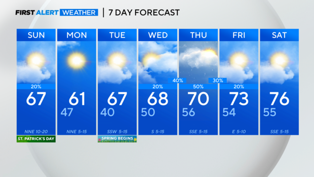
Partly sunny St. Patrick's Day in North Texas, a few dry days before rain returns later in the week
NORTH TEXAS - Happy St. Patrick's Day!
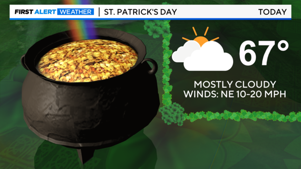
We are off to a grey start with temperatures in the mid to upper 50s. You may run into a little mist or drizzle this morning, but we are expecting some sunshine heading into the afternoon hours behind a cold front. The front will strengthen our northerly winds, bring in drier air and lead to a cooler Monday afternoon.
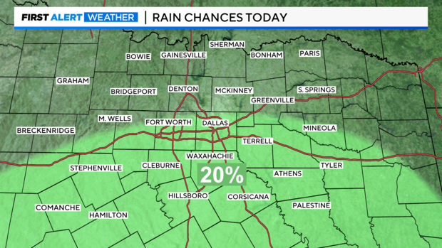
Before the drier air settles in and our skies clear, a disturbance will bring a few more showers to areas mainly south of I-20 today.
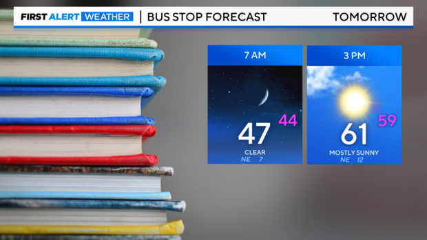
As the kids head back to school tomorrow they will want a jacket. Our clear morning starts with temperatures in the 40s and a brisk northerly wind with afternoon highs only in the lower 60s. But the sunshine is back in full force for our Monday, which should help the transition back to school.
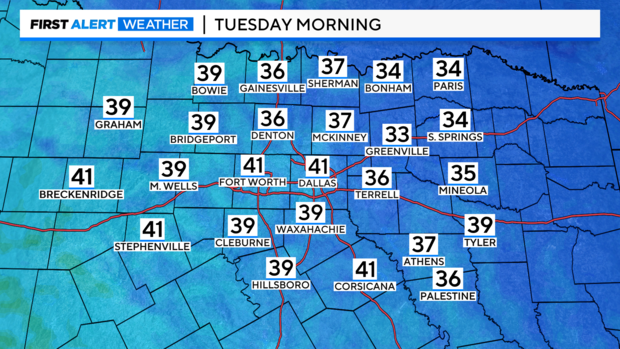
The cooler air is still in place heading into Monday night mixed with clear skies, means temperatures in the 30s. We may even see our Red River cities dropping to near freezing, so cover up any sensitive vegetation before heading to bed Monday night.
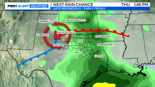
Then we are looking ahead to Thursday for our next chance of widespread rain, so don't tuck the rain gear away just yet. The cut off upper low that has been parked over the 4 corners for several days will finally weaken and move east, bringing rain to the area starting late Wednesday. This is the system responsible for the several rounds of rain we saw last week. It ejected disturbances in the flow that tracked right over us. As the low clears out of the area Friday we will dry out with warming temperatures heading into Saturday.