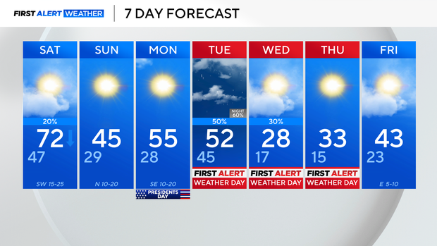
North Texas prepares for warm Saturday, cold Sunday, wintry mix midweek
NORTH TEXAS – We're dealing with some spotty showers this Valentine's evening, but the bulk of that scattered activity will stick to our eastern and southeastern counties as we head overnight and into Saturday.
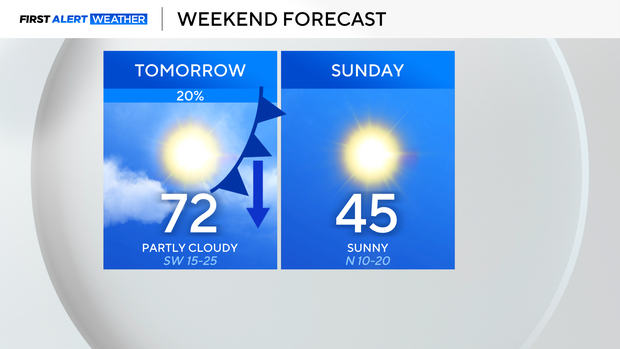
Our southerly flow has kicked in, which will keep temps in the 40s Saturday morning, then that wind gives us a big boost in temps, into the lower 70s Saturday afternoon. It will be a bit gusty, with those shower chances lingering to our east and southeast.
A cold front then moves in later in the day Saturday, and temps quickly drop. Highs on Sunday fall back to the middle 40s, but we will see the sunshine.
For Presidents' Day Monday, highs warm to the middle 50s with mainly sunny skies.
BIG changes follow all of this. For Tuesday, highs in the lower 50s. But an approaching system and arctic front looks to bring rain showers Tuesday afternoon... Then we're watching the potential for a transition to a wintry mix overnight into very early Wednesday morning. We are watching this timing closely.
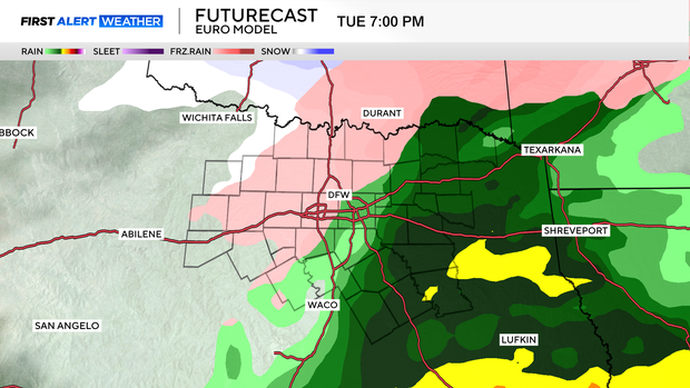
The moisture looks to clear fairly quickly, however, temperatures take a steep drop, which will bring the potential for ice and refreeze into Wednesday.
Wednesday and Thursday morning we're looking at air temps in the teens, which means wind chills will be in the single digits, and potentially even below zero for some.
Highs on Wednesday look to top out in the upper 20s.