Near record heat expected in North Texas through end of workweek
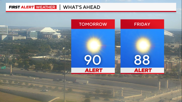
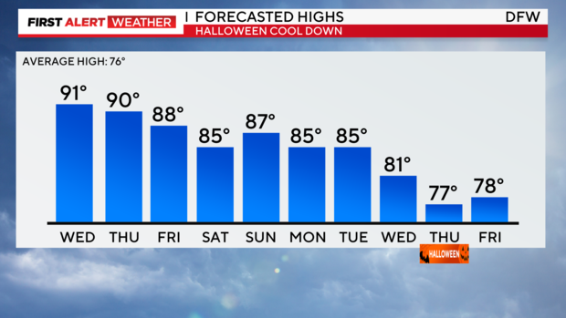
NORTH TEXAS – Howdy! A First Alert has been issued today for a high of 90 degrees, which came close to tying the record of 91 degrees set in 1939. The heat streak will continue throughout the rest of the work week, with forecast highs nearing previous records. As a result, First Alerts have been issued for Thursday and Friday.
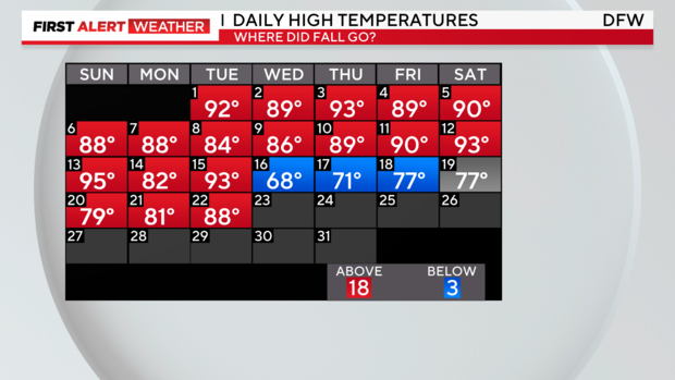
Temperatures have been toasty this October, not feeling like Fall at all! Only four days have recorded temperatures that were at or below average in the past 23 days.
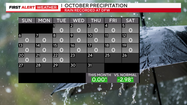
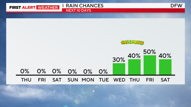
In addition to the on-going heat, the dry stretch also lingers. September 25th was the last day of measurable precipitation across DFW with none in sight through the weekend. The dry fuels will heighten the threat of wildfires on Thursday with winds gusting 20 to 25 mph across North Texas.
So far, the month of October has the potential of being one of the driest and hottest Octobers on record, however, there is some variability in the forecast exiting the month. The next big weather maker is anticipated to bring an uptick in precipitation and cooler temperatures, which could alleviate us from receiving the dryest and hottest October titles.
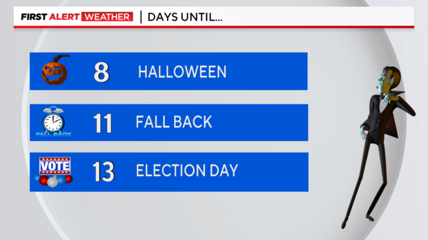
Let the countdown to Halloween, the end of Daylight-Saving Time, and election night begin! As big dates are around the corner, be sure to stay tuned for the latest forecast!
Have a great night!
