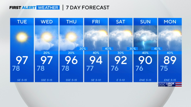
Near daily afternoon rain chances for North Texas and a cooler pattern ahead
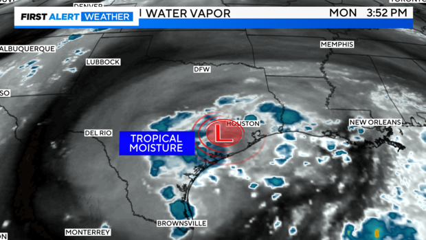
NORTH TEXAS — First, the upper-level tropical low is now moving into South Texas with plenty of deep moisture and even sparked some showers and storms Monday.
Expect more daily, afternoon chances over the next several days.
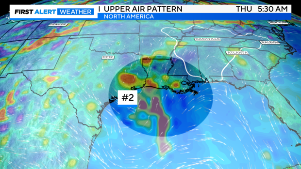
Next up: yet another tropical low could develop and move into Texas, possibly amplifying rain chances late week. Confidence in this is lower, so I've held off on raising rain chances for now, until greater consistency is reached between the major models.
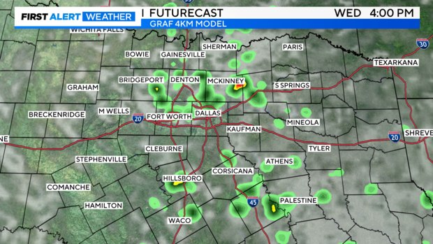
High-resolution futurecast continues to show good indications for pop-showers and storms the next few afternoons, but Tuesday appears to favor areas south of i20 perhaps a little more than Monday.
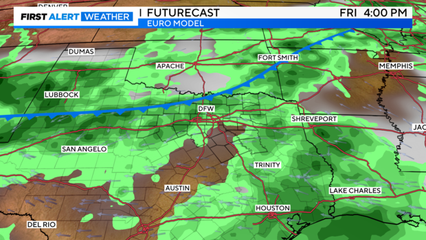
The European model's continued trend shows the cold front moving into the region Friday afternoon along with showers and storms. Because the upper-level disturbance in the jet stream is farther to the north, the Front won't entirely provide drier air or a huge drop in temperatures just yet, but perhaps more changes with a reinforcing shot of drier air behind another slight front the following Monday.
Here's the Euro's depiction of that reinforcing, smaller shot of cooler and drier air on Labor Day, along with showers and thunderstorms.
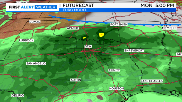
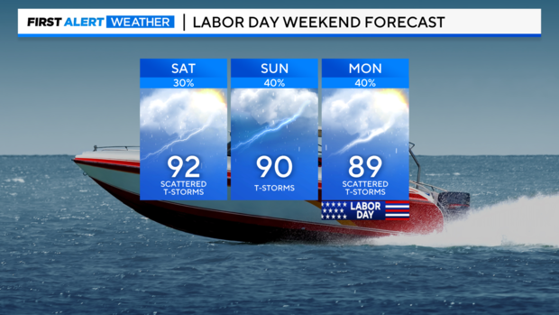
Early look at Labor Day weekend: this will NOT be a washout, but rather a cooler weekend with hit/miss scattered storms. There will still be breaks from the rain each day. '