NASA map captures extent of punishing heat in U.S.
The U.S. has contended with unrelenting temperatures this summer, and a map from NASA paints a dire picture of the scale of those persistent heat waves.
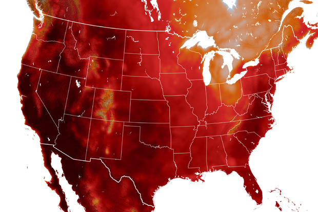
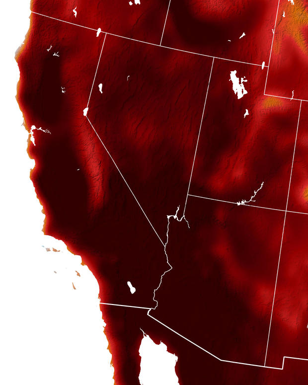
The map, which consists of a snapshot of temperatures nationwide for July 10, used satellite images — along with a complex mathematical model known as the Goddard Earth Observing System — to create a kind of color code, with dark red showing areas that reached highs of 104 degrees Fahrenheit, according to the NASA Earth Observatory, a program that examines the impact of climate change.
The results are stark, indicating potentially dangerous temperatures across nearly the entire continental U.S. The Southwest sustained the brunt of the heat, according to the map, with almost the entire region experiencing triple-digit highs.
The day the map was released, Las Vegas set a daily record of 118 degrees, which also marked the fifth straight day of temperatures 115 degrees or higher, a record as well, according to the National Weather Service.
Just three days prior, California's famous Death Valley hit a staggering 129 degrees on July 7, the National Park Service reported, just five degrees off the all-time world record of 134 degrees, which was set in 1913.
And on July 6, a Death Valley motorcyclist died from heat exposure as temperatures hit a high of 128 degrees, according to the National Park Service, and four other motorcyclists from his group were hospitalized. Officials told CBS News in a statement that it was too hot for park rangers to even call a helicopter to airlift them out.
The rest of the U.S. did not seem to fare much better. Oregon officials reported five possible heat-related deaths statewide on July 10, according to CBS affiliate KOIN, and at least 17 dating back to July 5.
And after tearing through the Caribbean, causing major damage and destruction, Hurricane Beryl made landfall in southeast Texas on July 8, knocking out power to more than three million customers in the Houston area. Millions remained without power for several days amid searing temperatures that saw the heat index — which measures what the temperature feels like to the human body, taking into account humidity — above 100 degrees.
The heat, meanwhile, shows no sign of abating this week, especially in the Northeast. Tuesday was expected to be one of the hottest days of the year so far for New York City, with a heat index also above 100. Mayor Eric Adams on Monday advised low-income residents to apply for a free air conditioner through the federal Home Energy Assistance Program.
Boston was also experiencing several days of highs in the low to mid-90s, and according to CBS Boston meteorologist Terry Eliasen, the city was on pace for one of the hottest and most humid Julys on record.
Washington, D.C., hit 104 degrees Tuesday, per the weather service. According to CBS affiliate WUSA, that tied a daily record set in 1988. It also marked the third straight day of triple-digit temperatures for the nation's capital.
According to the latest National Weather Service forecast, excessive heat watches and warnings were in place Tuesday for portions of the Pacific Northwest, the Southern Plains, the Middle and Lower Mississippi Valley, the Ohio and Tennessee valleys and the Central Gulf Coast.
"Extremely dangerous and potentially deadly heat, particularly for urban areas in the Southeast and East Coast, are forecast" through Wednesday, the weather service said.


