More rain and a few storms, mostly cloudy St. Patrick's Day in North Texas
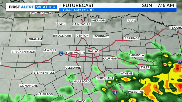
NORTH TEXAS - Our weekend is starting off cloudy and dry but keep the rain gear handy today as another round of precipitation arrives around midday. We remain in our active weather pattern with more rain and a few thunderstorms moving in from the west today. Luckily, the severe threat is low, so even though a few rumbles of thunder are possible we are not expecting the severe storms we saw earlier this week.
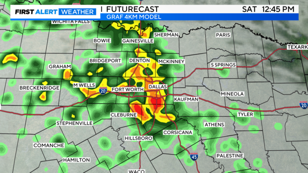
Shower activity will peak around noon in the Metroplex and head east during the afternoon hours.
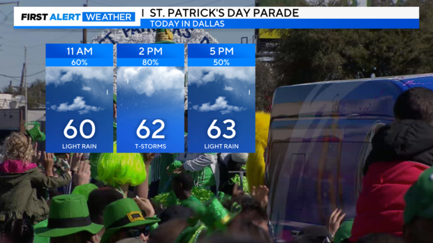
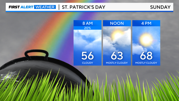
Unfortunately, we are looking at a wet and cool St. Patrick's Day parade.
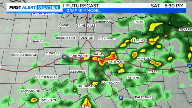
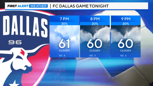
The rain will taper off from west to east this evening, so it won't be a complete washout for tonight's FC Dallas game in Frisco at 7:30 p.m.
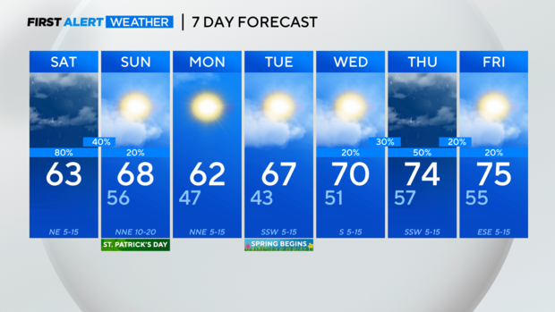
Tomorrow is looking much drier but still mostly cloudy. A few showers are possible during the morning hours mainly south of I-20.
Temperatures for our St. Patrick's day warm back into the upper 60s with partly sunny skies by the afternoon hours.
A cool front Sunday brings in a reinforcing shot of cooler air and will keep temperatures in the lower 60s Monday afternoon, but the sun is back! Spring starts on Tuesday and it is looking gorgeous with partly cloudy skies and highs near average. Then we are back to showers and storms Wednesday night into Thursday. Right now, the severe threat looks low, but we will continue to monitor it.