More mild temps ahead for North texas
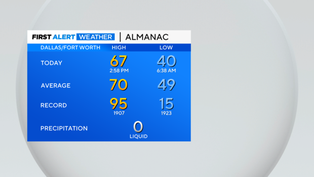
NORTH TEXAS — It was a very cold start to Tuesday, but temps rebounded into the mid and upper 60s in the afternoon! No rain, for now, but that all changes starting Wednesday night.
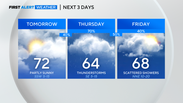
It will be cloudier Wednesday but also warmer. Rain chances pick up after midnight Wednesday and continue to increase heading into Thursday.
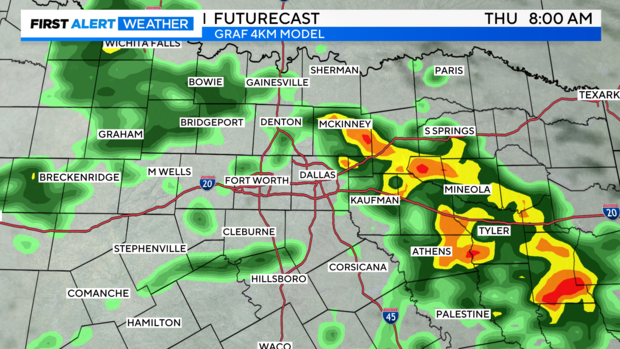
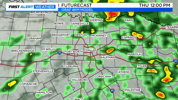
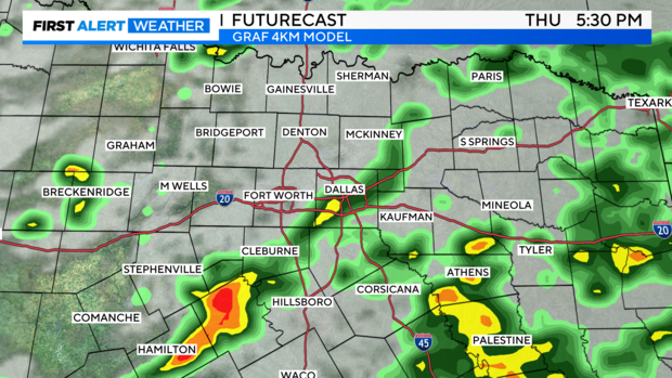
There will be rain around for the morning drive, as well as the afternoon and evening commute. It looks a bit more scattered closer to midday.
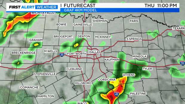
Into the evening, we could see a few slightly stronger storms to our south.
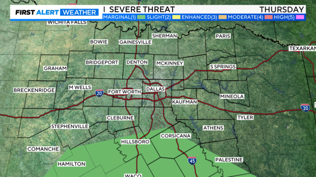
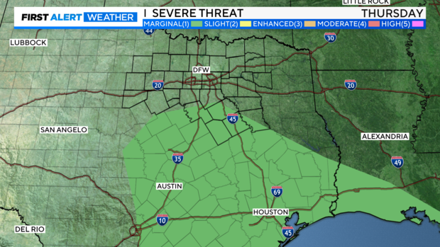
The severe threat is higher in Central Texas, where a widespread level 1 "marginal" risk is highlighted by the Storm Prediction Center. You'll see a few of our most southern counties are included in this.
Rain lingers into early Friday, but we should be clearing out into the afternoon and evening. Saturday looks like a great day! Sunday will be cloudier, and rain and storm chances pick back up Sunday night into Monday.
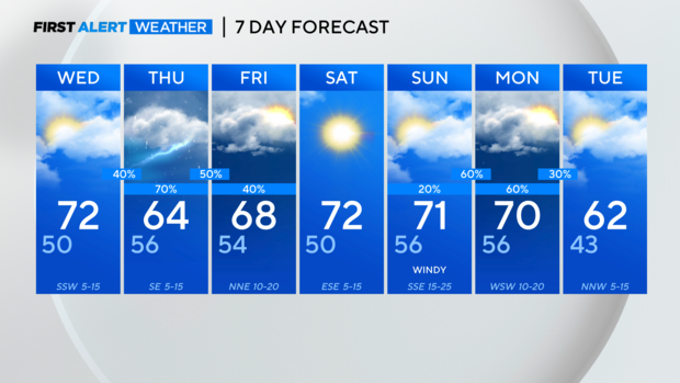
There could be some stronger storms with the system arriving late Sunday into Monday. For now, no weather alerts but we'll keep you updated!


