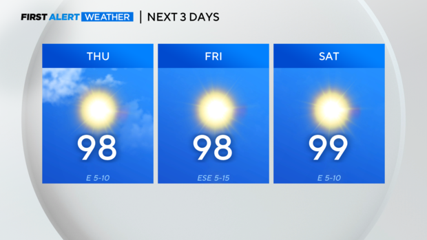
More 90s Thursday and Friday before triple-digit holiday weekend
NORTH TEXAS (CBSNewsTexas.com) - We're keeping the forecast highs below 100° for the next few days, but highs will be back into the triple digits for the Labor Day holiday.
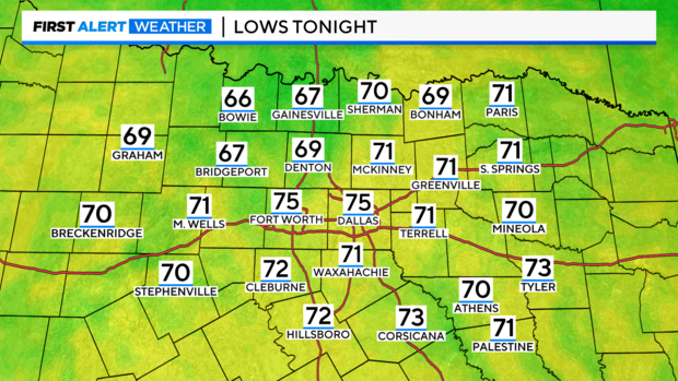
It should be another refreshing start to the day on Thursday, with some spots dropping into the 60s once again, though not at DFW with a forecast low in the mid-70s.
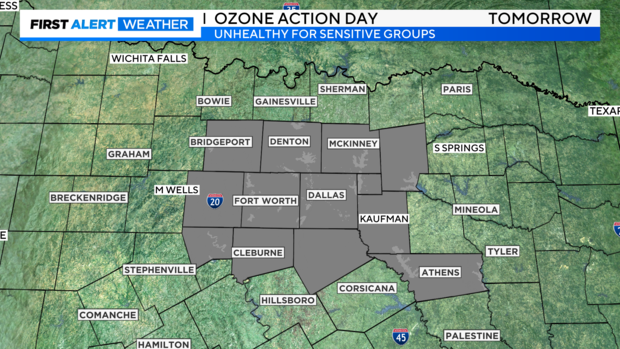
We do still have an Ozone Action Day on Thursday though, so people with upper respiratory issues may want to limit their time outdoors.
Just a reminder about what we saw with Idalia on Wednesday: The storm made landfall as a Category 3 hurricane around 6:45 a.m. CT. The storm has since weakened to a tropical storm, which makes sense given its continual interaction with land.
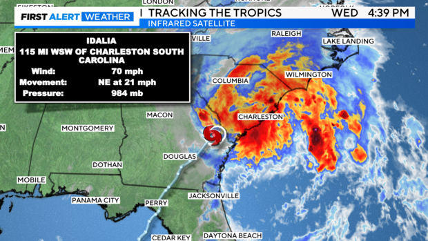
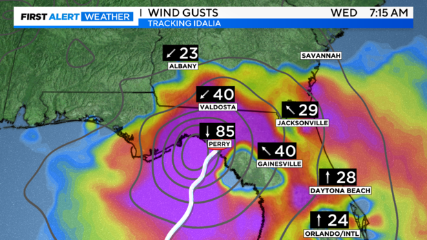
You can see the wind gusts in Perry, Fla. Wednesday morning, shortly after the time of landfall, at 85 mph.
The NHC official forecast calls for the storm to remain a tropical storm as it tracks close to the Carolina coastline overnight into Thursday, before moving out to sea Thursday afternoon.
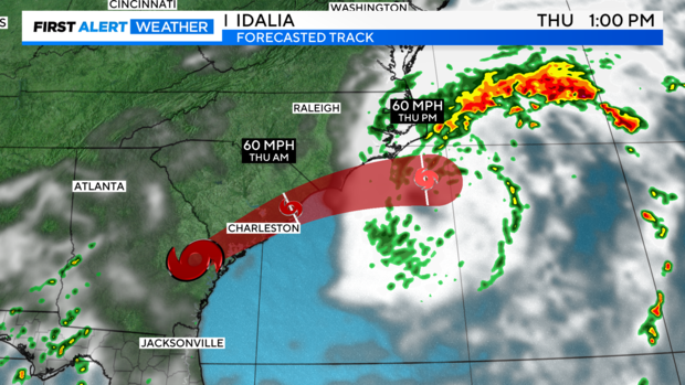
While the coast will deal with storm surges and strong winds, keep an eye out for flooding issues further inland. This happens a lot in the Carolinas in particular when tropical systems impact the coast.
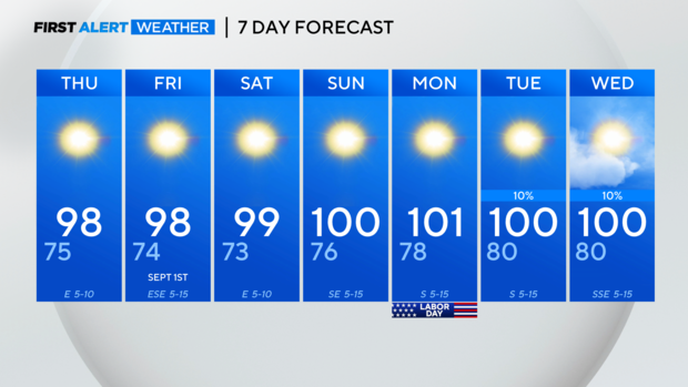
Locally, we hopefully won't see triple digits at DFW until Sunday!