Hot weather to continue in North Texas
NORTH TEXAS – Another heat alert has been issued through 9 p.m. Wednesday.
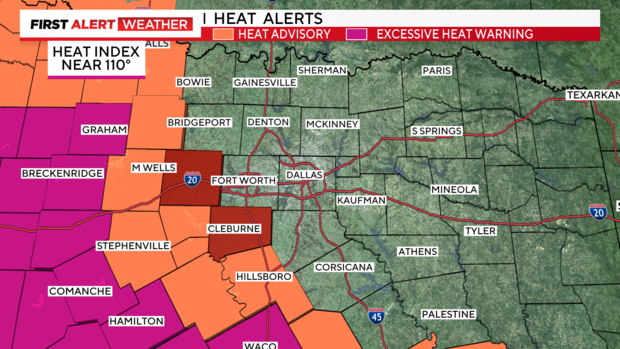
In the image below, excessive heat warnings cover the area in purple, heat advisories are orange and air quality alerts are red.
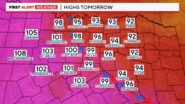
High temperatures will vary depending on the exact location of the front, which should be slowly sliding southwest over the next 12-24 hours.
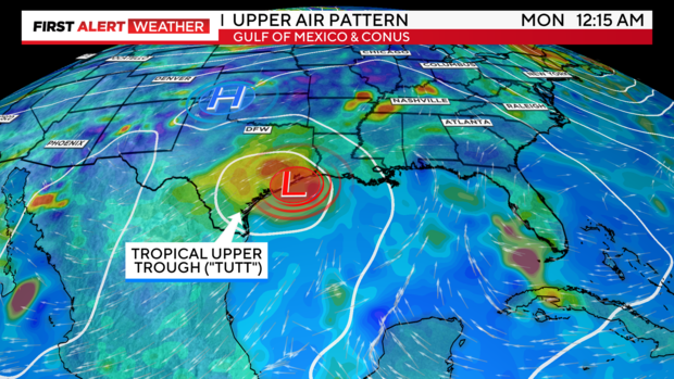
Looking forward, according to the American model (GFS), both major models are trending toward bringing a tropical upper-level tropospheric trough into Texas next week. While trends still favor south Texas, the GFS is starting to shift slightly northward, offering a better chance of rain.
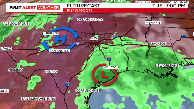
Here's the Euro futurecast's representation for early next week, which we'll still lean towards until more consistent trends start to emerge between both models. We don't want to overpromise and under-deliver on rain.
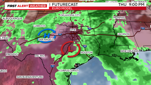
And late in the week, something interesting to note: the high-pressure ridge starts to weaken, and we may get some northwesterly and northerly flow, possibly bringing us a late-week front and showers and thunderstorms next week. That could provide some decent relief, unlike this week's…eh…"front." We shall see.
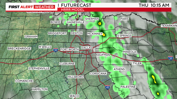
Here's a subtle shift that we'll also be watching: a few of the higher-resolution models are now trying to squeeze out a few raindrops on Thursday, mainly east of 75. We'll see if this trend holds, but confidence is low at this point. I doubt we'll be able to squeeze much moisture out of the atmosphere due to subsidence.
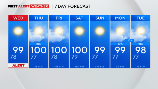
And here's the 7-day forecast.