Hot and muggy days ahead for North Texas

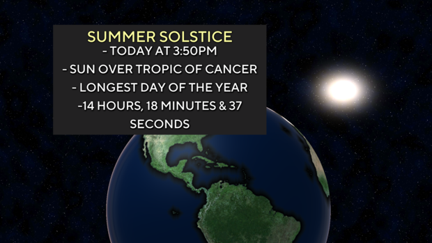
NORTH TEXAS — Welcome to Summer! The Summer Solstice happened at 3:50 p.m. CT Thursday with North Texas seeing approximately 14 hours and 18 minutes of daylight.
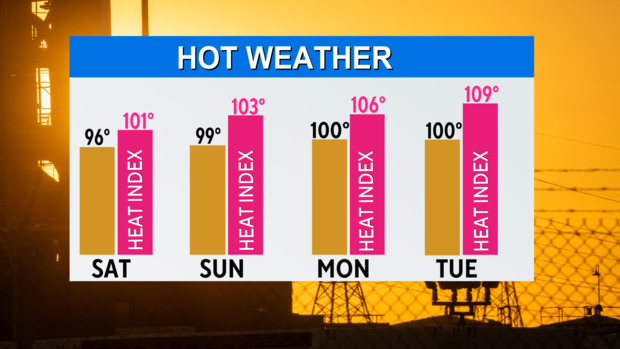
The high temperature reached slightly above average Thursday with a high of 93° but with dew point temps in the upper 60s to low 70s, temps felt more like the upper 90s.
Get used to that trend as it remains warm and muggy through the weekend and into next week. In fact, North Texas could see feels like temperatures reach 105°+ to start next week, which is heat advisory criteria.
The National Weather Service hasn't issued an advisory yet but this is something we are keeping an eye on in the First Alert Weather Center.
Why is North Texas drying out and getting hot? It is because of an area of high pressure in the upper levels that expands over the Southern Plains through the weekend and into next week. The heat dome will keep us hot through at least Tuesday before slightly weakening into Wednesday and Thursday.
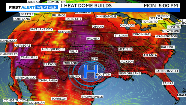
When high pressure is set up to the southwest of North Texas, that puts our upper-level flow into a northwest flow aloft. This means any storms that develop northwest of North Texas could travel into our area.
This is the same upper-level pattern in May that brought multiple rounds of rain and storms into North Texas overnight into the early morning hours.
The other big story we've tracked these past few days is Alberto. As of 4 p.m., the National Hurricane Center issued its last advisory on Alberto as there is no longer a center of circulation. The remnants continue moving west through Mexico.
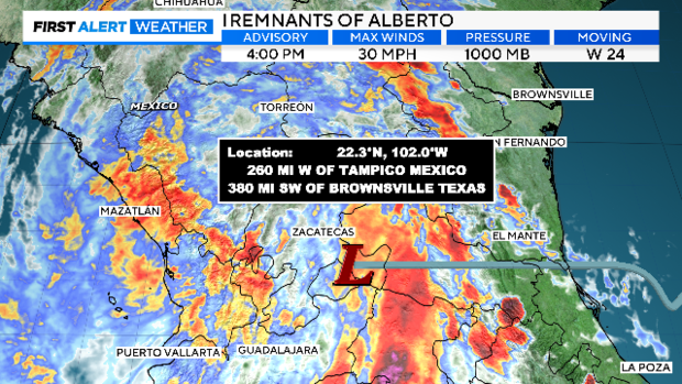
A few isolated showers continue Thursday night in the tropical environment with a 10% chance of a few more through the evening hours.
Friday, find a way to stay cool and keep that plan in place through most of the next 10 days!
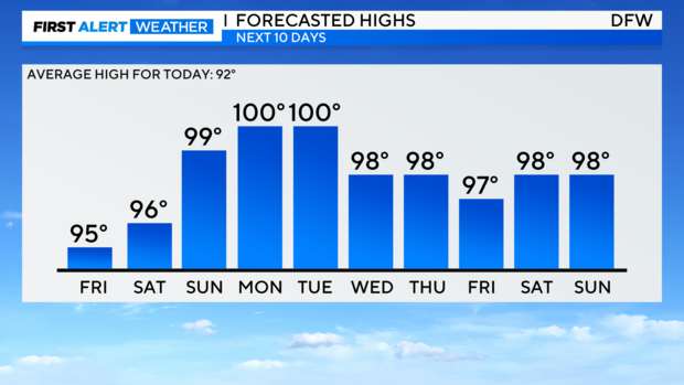
The metroplex cools down slightly from Wednesday to Thursday thanks to a weak front that looks to stall over North Texas and fizzle out. There is a small chance of showers with that boundary but we are still days away so we will see if this changes these next few days.