Hot and humid in North Texas with a chance of storms
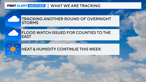
NORTH TEXAS — Another storm system is expected to develop in Oklahoma and move south overnight. This system will move into areas east and northeast of the metroplex late Tuesday night into Wednesday morning.
The latest timeframe looks to be closer to 3 a.m. for storms to move over the Red River, and they will gradually move south/east through mid-morning Wednesday.


It's likely these storms will remain east of I-35 and I-45, but a few storms further west can't be ruled out.

Heavy rainfall is expected with this system, and a Flood Watch has been issued for areas east of I-35 and I-45 from 10 p.m. Tuesday through 10 a.m. Wednesday.

Storms are expected to maintain some intensity as they cross the Red River. Damaging winds will be the greatest threat, with a lower threat of large hail.
Wednesday won't be quite as hot as Tuesday, with high temperatures reaching the upper 80s to mid 90s. Feels-like temperatures will reach between 100-105 degrees.
Thursday should be a storm-free day, the first since May 20. The lack of rain also means temperatures will rebound into the mid-upper 90s Thursday afternoon, approaching the record of 101° set back in 1974. Feels-like temperatures will certainly be higher.