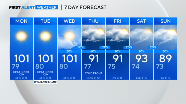
Hot and dry start to the week for North Texas
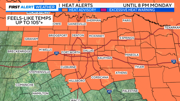
NORTH TEXAS — A heat advisory will be in place for North Texas through 8 p.m. Monday.
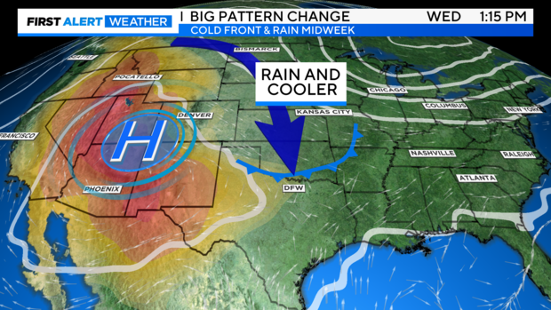
The upper-level high pressure will retreat to the west midweek, and a large dip in the jet stream will begin to dive into the central and southern plains. At the surface, North Texas will benefit from a rare July cold front and some rain/thunderstorms.
The front's timing is still not perfectly ironed out, and it could arrive earlier Wednesday, or as late as overnight into Thursday. Second, some of the storms could have a marginal severe threat, mainly for damaging winds, based on our environment. But widespread issues don't seem likely at this point.
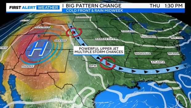
Following the front, multiple disturbances will ride this jet stream pattern down across the south and bring rain chances to round out the week and into the weekend.
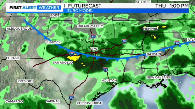
Here's the latest long-term futurecast. First, with the showers and storms along with the cold front and second, the lingering shower and storm chances into the weekend with more disturbances.
It's too early to tell at this point, but keep an eye on next weekend. Heavier showers and storms appear possible with a stronger impulse in the jet stream over our area. We'll see if this data holds or changes this week.
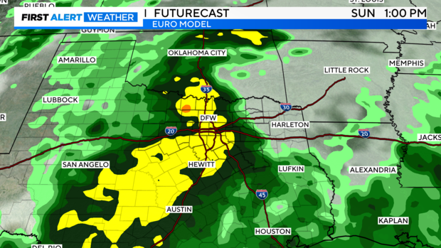
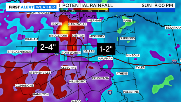
Model projected rainfall amounts are looking healthy! This is a projection through next Sunday evening. We'll see.