High pressure builds across Central U.S. bringing sweltering temperatures to North Texas
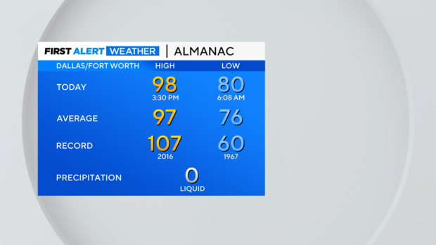
NORTH TEXAS — Our warmup has begun. After a high of 96° Sunday, we're back to an above-normal high of 98° Monday afternoon at DFW. Unfortunately, that's probably the "coolest" high we'll see for a while.
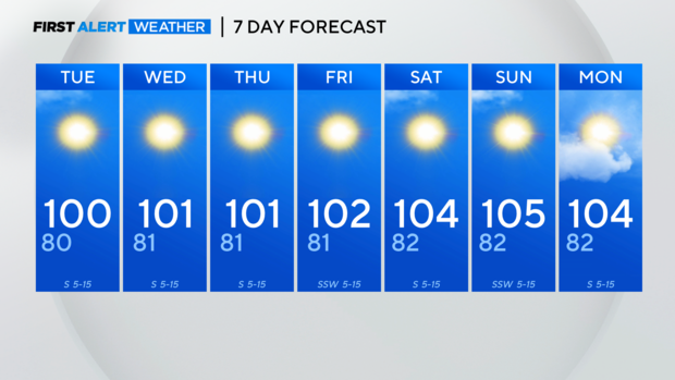
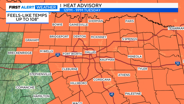
Highs should return to the triple digits for a lot of North Texas starting Tuesday, and only building as we get closer to the weekend.
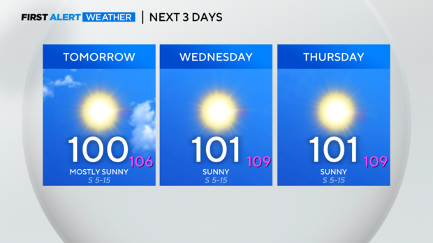
The heat index values will be well above the ambient temperature. A Heat Advisory goes into effect from 12 p.m. – 9 p.m. Tuesday, and it will likely be extended each afternoon for the next day.
An Excessive Heat Warning would prompt a weather alert from our First Alert Weather Team. We'll keep an eye on it and let you know as soon as a warning is issued.
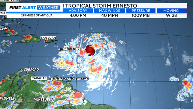
We have our next named tropical system in the Atlantic. As of 4 p.m. Monday, we are tracking Tropical Storm Ernesto.
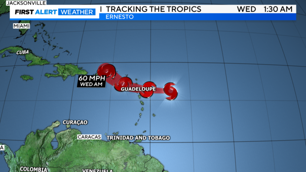
Ernesto will continue strengthening while moving westward, impacting the Leeward Islands late Monday night and the Virgin Islands and Puerto Rico late Tuesday into early Wednesday.
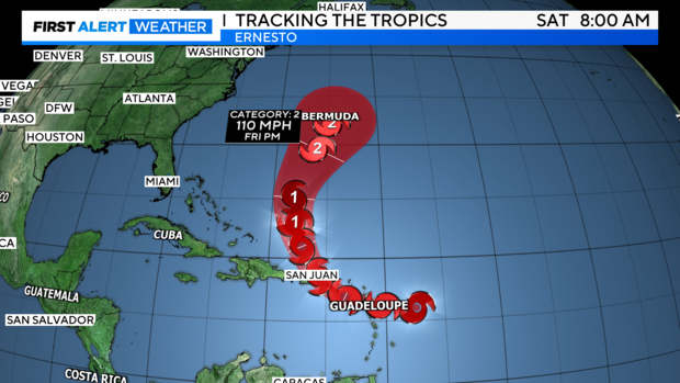
While it's too early to say for sure what Ernesto will do, between high-pressure building across the Central U.S. (the reason for our sweltering heat late this week), and a trough digging across the eastern portion of the U.S., it makes sense that most models eventually steer this storm north, keeping it away from the east coast. With little to no land interaction though, the storm will be able to strengthen as it approaches Bermuda late this week into the weekend.