Heavy rainfall, winds expected in North Texas from Hurricane Beryl, flooding may be possible

NORTH TEXAS — Beryl made landfall along the Texas Gulf Coast as a category 1 hurricane. The National Hurricane Center updated at 11 p.m. to upgrade Beryl's 75 mph winds and a Category 1 Hurricane. North Texas can expect winds and heavy rainfall. Flash flooding is possible.
The center of circulation is forecast to pass right over Houston, which is under a hurricane warning. Downtown Houston could see winds over 80 mph. Galveston is also under a hurricane warning and could see storm surge of 4 to 6 feet. Flooding is almost certain.
The hurricane will weaken to a tropical storm as it moves inland. The center will move over East Texas, missing most or all of the North Texas counties.
Still, wind gusts in the metroplex could get over 35 mph, with winds stronger in eastern counties.
Storm timing for North Texas
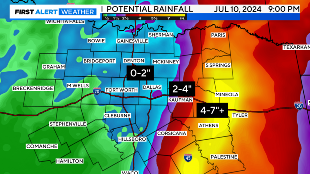
10 a.m. - 3 p.m.: Heavier showers and thunderstorms are possible in the metroplex and especially points to the east. If more showers and storms develop between the frontal boundary and Beryl, they could drop fast-hitting, heavy rainfall.
3 p.m. - 6 p.m.: Remaining activity should diminish or exit East/Northeast.
The latest track shifts a weakening Beryl further east of DFW.
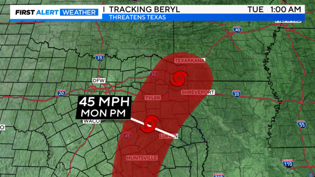
All in all, the heaviest rainfall is trending east of the Metroplex with a steep drop-off to the west of Beryl's potential track. However, due to the interaction with the frontal boundary moving in from the northwest and Beryl, there certainly could be locally much higher amounts if stronger storms develop right over DFW.
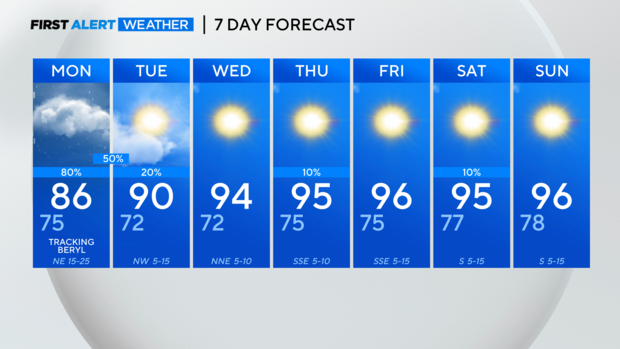
Starting late this week and into next week, a large upper-level ridge of high pressure will sit over the South and expand across the central and western U.S. We could see extreme heat build back in for the extended forecast as a result.
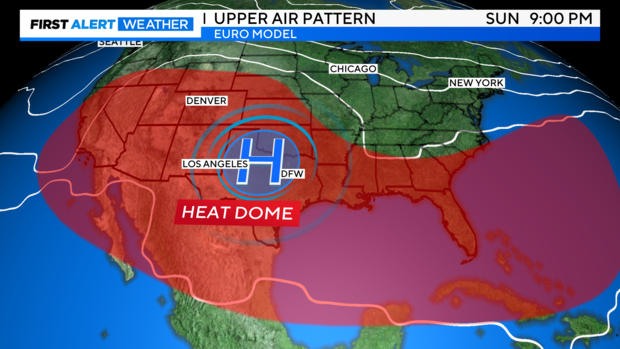
For the 7-day forecast, Beryl and its associated activity exit the region quickly followed by more heat.